
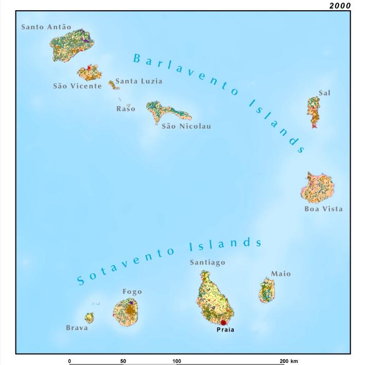
Cabo Verde 500-m Land Use Land Cover 2000
By Earth Resources Observation and Science (EROS) Center
2000 (approx.)
Detailed Description
Map of land use and land cover in the Cabo Verde archipelago at 1-km resolution, circa 2000, used for the U.S. Geological Survey project "Landscapes of West Africa: A Window on a Changing World."
Sources/Usage
Public Domain.