



Capitola State Beach mapping


Detailed Description
Reflectors are placed throughout a lidar scan area to help reference where the lidar points are in space. Andrew Stevens, USGS, surveys Capitola Beach, walks past a reflector mounted on a tall, yellow tripod in front of the light blue building.
Sources/Usage
Public Domain.
Related
El Niño Coastal Hazards (2026-2027)
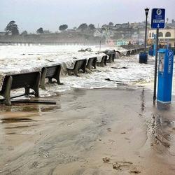
The 2026-2027 El Niño is projected to be the largest and most intense on record. Pacific storms during previous El Niño events have caused widespread coastal hazards along the California coast from flooding and erosion. The USGS is uniquely positioned to assist with coastal monitoring, data collection, science and communications with partners about these pending hazards.

Climate impacts on Monterey Bay area beaches
For beach towns around Monterey Bay, preserving the beaches by mitigating coastal erosion is vital. Surveys conducted now and regularly in the future will help scientists understand the short- and long-term impacts of climate change, El Niño years, and sea-level rise on a populated and vulnerable coastline.
Related
El Niño Coastal Hazards (2026-2027)
The 2026-2027 El Niño is projected to be the largest and most intense on record. Pacific storms during previous El Niño events have caused widespread coastal hazards along the California coast from flooding and erosion. The USGS is uniquely positioned to assist with coastal monitoring, data collection, science and communications with partners about these pending hazards.
Climate impacts on Monterey Bay area beaches
For beach towns around Monterey Bay, preserving the beaches by mitigating coastal erosion is vital. Surveys conducted now and regularly in the future will help scientists understand the short- and long-term impacts of climate change, El Niño years, and sea-level rise on a populated and vulnerable coastline.