
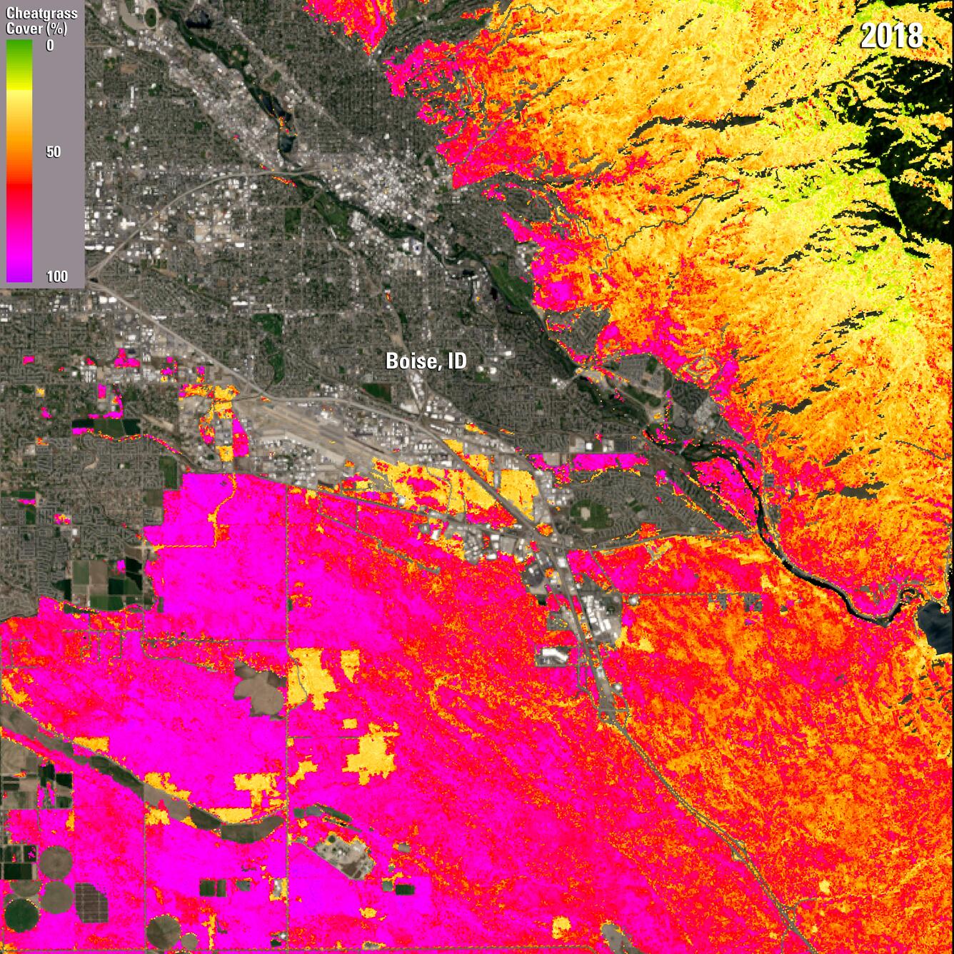
Cheatgrass - Boise, ID 2018
By Earth Resources Observation and Science (EROS) Center
2018 (approx.)
Detailed Description
Improved cheatgrass mapping products from the USGS Earth Resources Observation and Science (EROS) Center offer a higher resolution picture of invasive grass extent than previously available across parts of the Western U.S. This image shows a 2018 cheatgrass coverage map for the Boise, ID area, atop a Landsat 8 image of the same area.
Sources/Usage
Public Domain.