
Chirp profile through shoreface at Fire Island, NY
Detailed Description
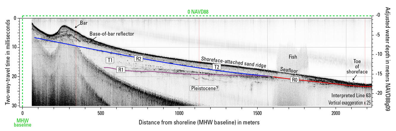
Above is a seismic profile collected from the shoreface of Fire Island, NY (Locker et al., 2017), which shows a steep shoreface, a nearshore bar, a sand ridge, and the geology beneath it all. The sediment above the blue and red lines is thought to be available for transport by waves or longshore drift. We map and quantify this volume of sediment along barrier islands, which improves estimates of shoreface sediment flux and connects geologic observations to models.
Sources/Usage
Public Domain.
Related

Shoreface Morphology and Geology
Exchanges of sediment between the shoreface and barrier islands allow barrier islands to adjust to changes in water level, such as those associated with storms or sea-level rise. Characterizing shoreface morphology and geology allows us to explore how past and present processes have impacted modern barrier island sediment transport and what that means for future barrier island evolution.
Related
Shoreface Morphology and Geology
Exchanges of sediment between the shoreface and barrier islands allow barrier islands to adjust to changes in water level, such as those associated with storms or sea-level rise. Characterizing shoreface morphology and geology allows us to explore how past and present processes have impacted modern barrier island sediment transport and what that means for future barrier island evolution.