
Colorado River Basin
Detailed Description
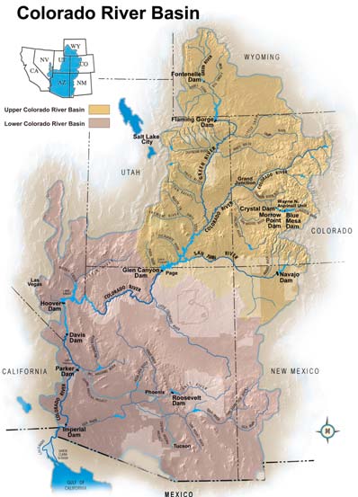
Map showing the Upper and Lower Colorado River Basin, with the river extending from Wyoming, Colorado, and New Mexico through Arizona, Nevada, and California to the Gulf of California.
Sources/Usage
Public Domain.
This map has been included on the Bureau of Reclamation's Annual Operating Plans for Colorado River Reservoirs since 2007 without notice of the figure being under copyright.