
Colored Shaded-Relief Bathymetry of San Francisco

Detailed Description
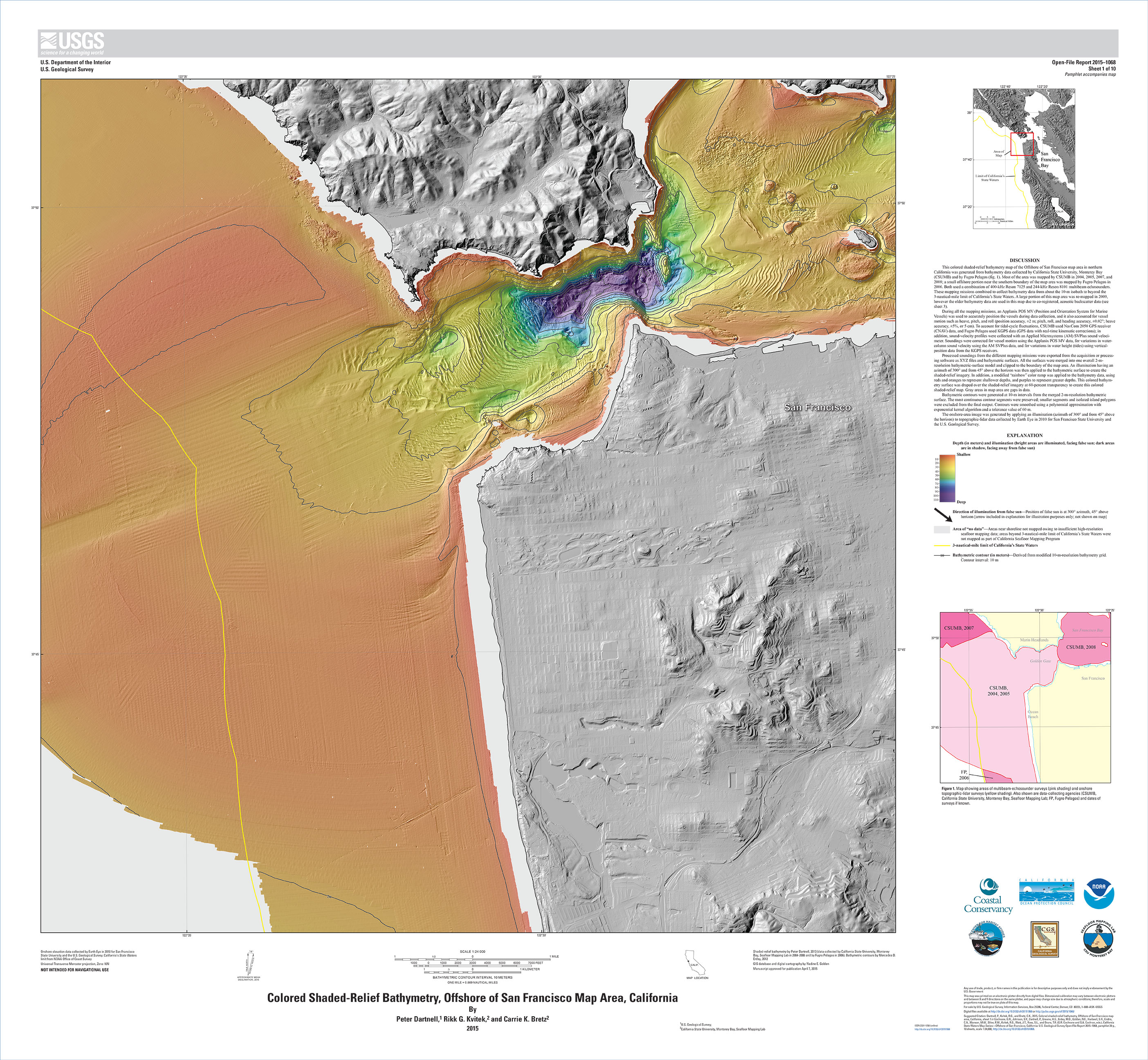
This colored shaded-relief bathymetry map of the Offshore of San Francisco map area in northern California was generated from bathymetry data collected by California State University, Monterey Bay (CSUMB) and by Fugro Pelagos (fig. 1). Most of the area was mapped by CSUMB in 2004, 2005, 2007, and 2008; a small offshore portion near the southern boundary of the map area was mapped by Fugro Pelagos in 2006. Both used a combination of 400-kHz Reson 7125 and 244-kHz Reson 8101 multibeam echosounders. These mapping missions combined to collect bathymetry data from about the 10-m isobath to beyond the 3-nautical-mile limit of California’s State Waters.
Sources/Usage
Public Domain.
Colored Shaded-Relief Bathymetry, Offshore of San Francisco Map Area, California
This is Map Sheet 1, “Colored Shaded-Relief Bathymetry, Offshore of San Francisco Map Area, California,” from:
Cochrane, G.R., Johnson, S.Y., Dartnell, P., Greene, H.G., Erdey, M.D., Golden, N.E., Hartwell, S.R., Endris, C.A., Manson, M.W., Sliter, R.W., Kvitek, R.G., Watt, J.T., Ross, S.L., and Bruns, T.R. (G.R. Cochrane and S.A. Cochran, eds.), 2015, California State Waters Map Series—Offshore of San Francisco, California (ver. 1.1, June 2015): U.S. Geological Survey Open-File Report 2015–1068, pamphlet 39 p., 10 sheets, scale 1:24,000, https://doi.org/10.3133/ofr20151068
Related

California Seafloor and Coastal Mapping Program
Related