
Computed tomographic image animation of a coral core
By Pacific Coastal and Marine Science Center
2019 (approx.)
Detailed Description
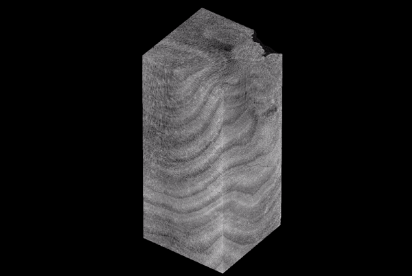
In 2019, the USGS Pacific Coastal and Marine Science Center in Santa Cruz, California acquired of a state-of-the-art Geotek core-imaging system that has the capability to use computed tomography (CT) to produce high-resolution, three-dimensional reconstructions of density patterns in cores. A CT scan of a coral core, like the one shown here, helps researchers analyze coral colony growth, bioerosion, porosity, and surface area. The measurements can be used to reconstruct past climate variability and identify periods of thermal or aqueous stress, and to determine how environmental change influences long-term rates of coral growth and erosion.
Sources/Usage
Public Domain.
Related

Developing a USGS Digital Coral Growth Archive using Rotating X-Ray Computerized Tomography - The ACTS Project
The Archival Computed Tomography Scanning Project (ACTS) currently develops the USGS Coral Core Archive, housed at the Pacific and St. Petersburg Coastal and Marine Science Centers, that contains approximately 500 coral reef cores from U.S. jurisdictions worldwide. This archive, is one of the largest coral archives in the world and provides historical context for coral-reef science studies...
Related
Developing a USGS Digital Coral Growth Archive using Rotating X-Ray Computerized Tomography - The ACTS Project
The Archival Computed Tomography Scanning Project (ACTS) currently develops the USGS Coral Core Archive, housed at the Pacific and St. Petersburg Coastal and Marine Science Centers, that contains approximately 500 coral reef cores from U.S. jurisdictions worldwide. This archive, is one of the largest coral archives in the world and provides historical context for coral-reef science studies...