Research Geologist with the USGS Pacific Coastal and Marine Science Center
Research Focus
2020-present: Geologist, USGS, Santa Cruz, CA, USA. I am currently involved in three fields of research: groundwater discharge through coastal aquifers; conceptualizing hydrologically and cryogenically driven permafrost erosion; and physicochemical drivers of coral reef health. I also created the Unmanned Aerial System Coastal Aquifer Project, which develops new drone-based technologies to investigate permafrost stability, wetlands, and aquifers. All projects have a strong interdisciplinary nature focusing on anthropogenic versus natural disturbances that rely on a multitude of oceanographic, marine geological, hydrogeological, and geochemical methods. As part of my older research interests I also continue to collaborate and advise on research focusing on the geological and geochemical consequences of bottom trawling.
Professional Experience
2020-present: Geologist, USGS, Santa Cruz, CA
2016, Mendenhall Postdoctoral Researcher, USGS
2014, Visiting Professor, Quest University, Squamish (Vancouver), BC, Canada
2013, Visiting Scientist at the USGS, Santa Cruz and Menlo Park, CA, USA
2008-2011, Adjunct Professor, Chabot-Las Positas College, Livermore, CA, USA
2007-2011, Sedimentologist/Hydrogeologist, Garcia & Associates, San Anselmo, CA, USA
2006-2007, Middle School Oceanography Teacher, San Francisco Maritime Assoc., CA, USA
2002-2003, Staff Geologist, German Environmental Protection Agency, Rheinfelden, Germany
2000-2001, NASA Space Grant Fellowship, Hawaii Space Consortium, Honolulu, HI, USA
Education and Certifications
2015, MARUM-IODP Center, University of Bremen, Germany, Ph.D. (Dr. rer. nat.)
2012 - 2014, Woods Hole Oceanographic Institution (WHOI), Ph.D. study with Chris Reddy
2005, University of Bremen, Germany – M.S. Environmental and Marine Geology
2002, Bowdoin College, USA – B.A. Geology
2000 - 2001, (SOEST) School of Ocean and Earth Science and Technology, Hawaii
Science and Products
Coral Reef Project
Hydrogeology and Reef Health
Climate impacts to Arctic coasts
Submarine Groundwater Discharge
Near-shore seawater-column measurements of excess radon (Rn-222) and water levels, Faga'alu Bay, Tutuila, American Samoa, August 2018
Physicochemical coastal groundwater dynamics between Kauhakō Crater lake and Kalaupapa settlement, Moloka‘i, Hawai‘i
Vadose zone thickness limits pore-fluid pressures and acceleration in a large, slow-moving landslide
High-resolution observations of submarine groundwater discharge reveal the fine spatial and temporal scales of nutrient exposure on a coral reef: Faga'alu, AS
Late Holocene environmental change in Celestun Lagoon, Yucatan, Mexico
Physicochemical controls on zones of higher coral stress where Black Band Disease occurs at Mākua Reef, Kauaʻi, Hawaiʻi
Towards determining spatial methane distribution on Arctic permafrost bluffs with an unmanned aerial system
Atoll groundwater movement and its response to climatic and sea-level fluctuations
Fishing activities
What a drag: Quantifying the global impact of chronic bottom trawling on continental shelf sediment
Wave-driven sediment mobilization on a storm-controlled continental shelf (Northwest Iberia)
Non-USGS Publications**
**Disclaimer: The views expressed in Non-USGS publications are those of the author and do not represent the views of the USGS, Department of the Interior, or the U.S. Government.
Science and Products
- Science
Coral Reef Project
Explore the fascinating undersea world of coral reefs. Learn how we map, monitor, and model coral reefs so we can better understand, protect, and preserve our Nation's reefs.Hydrogeology and Reef Health
As part of the USGS Coral Reef Project, we are conducting geophysical and geochemical research to address questions about coastal groundwater-to-reef flow and coral reef health, with the goal of informing management decisions related to planning and implementing activities in priority watershed-coral reef systems.Climate impacts to Arctic coasts
The Arctic region is warming faster than anywhere else in the nation. Understanding the rates and causes of coastal change in Alaska is needed to identify and mitigate hazards that might affect people and animals that call Alaska home.Submarine Groundwater Discharge
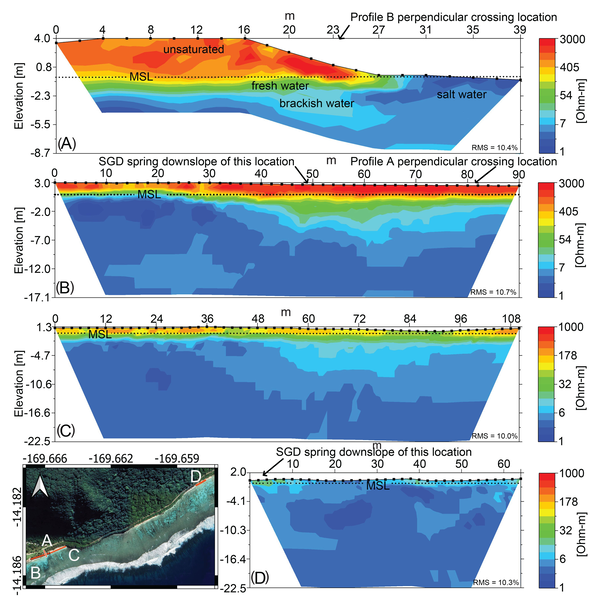
We define submarine groundwater discharge (SGD) to consist either of fresh groundwater, re-circulated seawater, or a composite thereof. We evaluate and present SGD in terms of a vector for nutrient delivery to coastal waters. - Data
Near-shore seawater-column measurements of excess radon (Rn-222) and water levels, Faga'alu Bay, Tutuila, American Samoa, August 2018
This data table includes in-situ near-shore seawater measurements of excess radon (Rn-222) and water levels collected in Faga'alu Bay, Tutuila, American Samoa. - Multimedia
- Publications
Physicochemical coastal groundwater dynamics between Kauhakō Crater lake and Kalaupapa settlement, Moloka‘i, Hawai‘i
Land-based sources of groundwater pollution can be a critical threat to coral reefs, and a better understanding of “ridge-to-reef” water movement is required to advance management and coral survival in the Anthropocene. In this study a more complete understanding of the geological, atmospheric, and oceanic drivers behind coastal groundwater exchange on the Kalaupapa peninsula, on Moloka‘i, Hawai‘iAuthorsFerdinand Oberle, Olivia Cheriton, Peter W Swarzenski, Eric K. Brown, Curt D. StorlazziVadose zone thickness limits pore-fluid pressures and acceleration in a large, slow-moving landslide
The rate and timing of hydrologically forced landslides is a complex function of precipitation patterns, material properties, topography, and groundwater hydrology. In the simplest form, however, slopes fail when subsurface pore pressure grows large enough to exceed the Mohr-Coulomb failure criterion. The capacity for pore pressure rise in a landslide is determined in part by the thickness of theAuthorsC.R. Murphy, N.J. Finnegan, Ferdinand OberleHigh-resolution observations of submarine groundwater discharge reveal the fine spatial and temporal scales of nutrient exposure on a coral reef: Faga'alu, AS
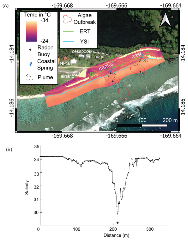
Submarine groundwater discharge (SGD) can deliver substantial nutrient and contaminant loads to nearshore coral reefs. Correctly scaling SGD rates from a point source to a reef is generally a linear process involving simplified assumptions on the hydrogeology, bathymetry, and nearshore hydrodynamics that are essential to properly assess SGD scale and impact to individual coral heads. Here, we applAuthorsFerdinand Oberle, Nancy G. Prouty, Segun B. Adebayo, Curt StorlazziLate Holocene environmental change in Celestun Lagoon, Yucatan, Mexico
Epikarst estuary response to hydroclimate change remains poorly understood, despite the well-studied link between climate and karst groundwater aquifers. The influence of sea-level rise and coastal geomorphic change on these estuaries obscures climate signals, thus requiring careful development of paleoenvironmental histories to interpret the paleoclimate archives. We used foraminifera assemblagesAuthorsKyle Hardage, Joseph Street, Jorge A. Herrera-Silveira, Ferdinand Oberle, Adina PaytanPhysicochemical controls on zones of higher coral stress where Black Band Disease occurs at Mākua Reef, Kauaʻi, Hawaiʻi
Pervasive and sustained coral diseases contribute to the systemic degradation of reef ecosystems, however, to date an understanding of the physicochemical controls on a coral disease event is still largely lacking. Water circulation and residence times and submarine groundwater discharge all determine the degree to which reef organisms are exposed to the variable chemistry of overlying waters; undAuthorsFerdinand Oberle, Curt D. Storlazzi, Olivia Cheriton, Renee K. Takesue, Daniel J. Hoover, Joshua B. Logan, Christina M. Runyon, Christina A. Kellogg, Cordell Johnson, Peter W. SwarzenskiTowards determining spatial methane distribution on Arctic permafrost bluffs with an unmanned aerial system
Arctic permafrost stores vast amounts of methane (CH4) in subsurface reservoirs. Thawing permafrost creates areas for this potent greenhouse gas to be released to the atmosphere. Identifying ‘hot spots’ of methane flux on a local scale has been limited by the spatial scales of traditional ground-based or satellite-based methane-sampling methods. Here we present a reliable and an easily replicableAuthorsFerdinand K. J. Oberle, Ann E. Gibbs, Bruce M. Richmond, Li H. Erikson, Mark P. Waldrop, Peter W. SwarzenskiAtoll groundwater movement and its response to climatic and sea-level fluctuations
Groundwater resources of low-lying atoll islands are threatened due to short-term and long-term changes in rainfall, wave climate, and sea level. A better understanding of how these forcings affect the limited groundwater resources was explored on Roi-Namur in the Republic of the Marshall Islands. As part of a 16-month study, a rarely recorded island-overwash event occurred and the island’s aquifeAuthorsFerdinand K. J. Oberle, Peter W. Swarzenski, Curt D. StorlazziFishing activities
Unlike the major anthropogenic changes that terrestrial and coastal habitats underwent during the last centuries such as deforestation, river engineering, agricultural practices or urbanism, those occurring underwater are veiled from our eyes and have continued nearly unnoticed. Only recent advances in remote sensing and deep marine sampling technologies have revealed the extent and magnitude of tAuthorsFerdinand K. J. Oberle, Pere Puig, Jacobo MartinWhat a drag: Quantifying the global impact of chronic bottom trawling on continental shelf sediment
Continental shelves worldwide are subject to intense bottom trawling that causes sediment to be resuspended. The widely used traditional concepts of modern sedimentary transport systems on the shelf rely only on estimates for naturally driven sediment resuspension such as through storm waves, bottom currents, and gravity-driven flows but they overlook a critical anthropogenic factor. The strong inAuthorsFerdinand K. J. Oberle, Curt D. Storlazzi, Till J.J. HanebuthWave-driven sediment mobilization on a storm-controlled continental shelf (Northwest Iberia)
Seafloor sediment mobilization on the inner Northwest Iberian continental shelf is caused largely by ocean surface waves. The temporal and spatial variability in the wave height, wave period, and wave direction has a profound effect on local sediment mobilization, leading to distinct sediment mobilization scenarios. Six grain-size specific sediment mobilization scenarios, representing seasonal aveAuthorsFerdinand Oberle, Curt D. Storlazzi, Till HanebuthNon-USGS Publications**
Proceedings of the International Conference on DELTAS: Geological Modeling and Management. AIST, Ho Chi Minh City, VietnamAbstract, Geological Society of America, Northeastern Section, 38th MeetingNASA Space Consortium**Disclaimer: The views expressed in Non-USGS publications are those of the author and do not represent the views of the USGS, Department of the Interior, or the U.S. Government.
- News