Critical Minerals in Landsat 9

Detailed Description
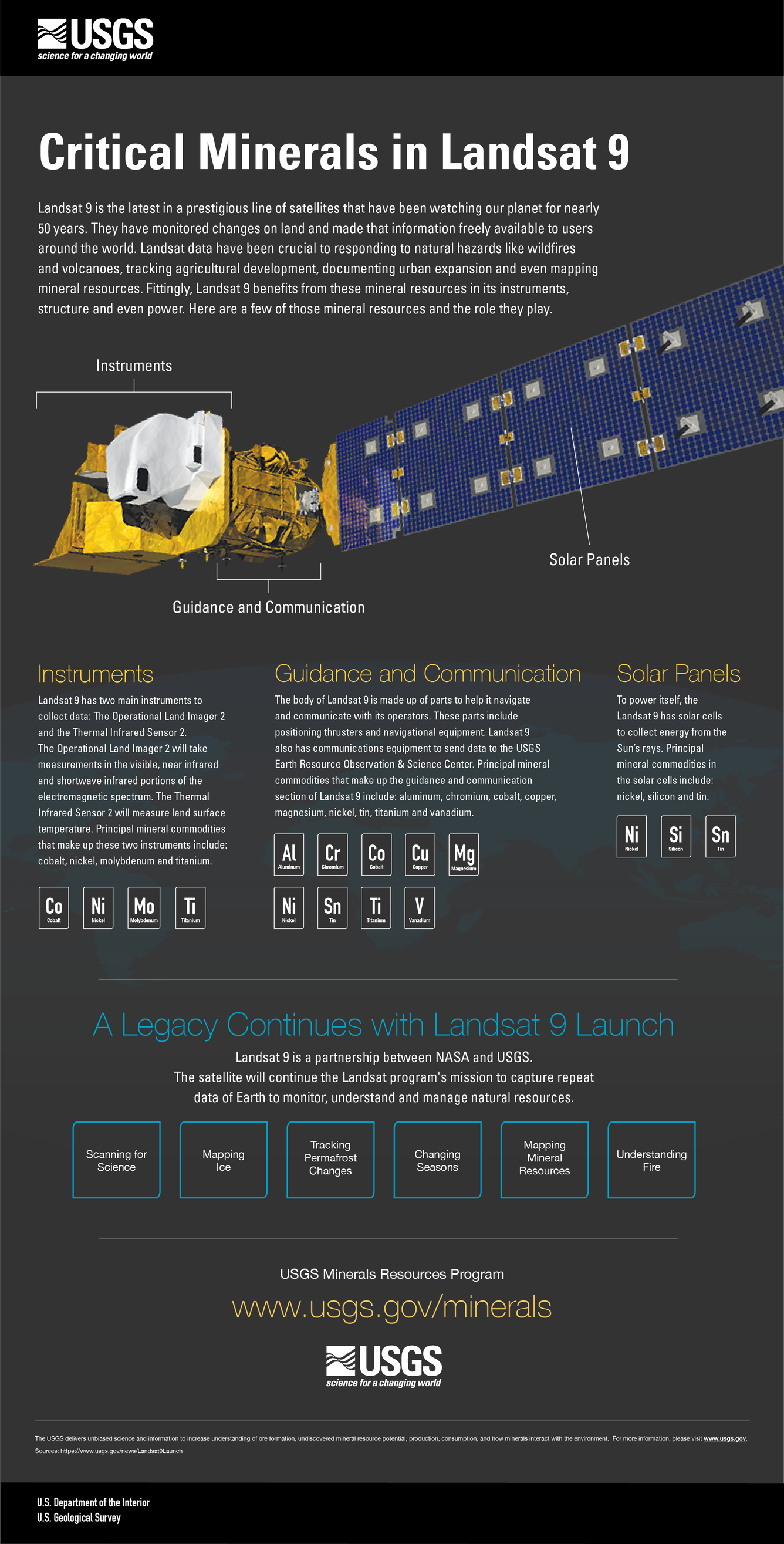
Landsat 9 is the latest in a prestigious line of satellites that have been watching our planet for nearly 50 years. They have monitored changes on land and made that information freely available to users around the world. Landsat data have been crucial to responding to natural hazards like wildfires and volcanoes, tracking agricultural development, documenting urban expansion and even mapping mineral resources. Fittingly, Landsat 9 benefits from these mineral resources in its instruments, structure and even power. Here are a few of those mineral resources and the role they play.
Instruments
Landsat 9 has two main instruments to collect data: The Operational Land Imager 2 and the Thermal Infrared Sensor 2. The Operational Land Imager 2 will take measurements in the visible, near infrared and shortwave infrared portions of the electromagnetic spectrum. The Thermal Infrared Sensor 2 will measure land surface temperature. Principal mineral commodities that make up these two instruments include: cobalt, nickel, molybdenum and titanium.
- Co-Cobalt
- Ni-Nickel
- Mo-Molybdenum
- Ti-Titanium
Guidance and Communication
The body of Landsat 9 is made up of parts to help it navigate and communicate with its operators. These parts include positioning thrusters and navigational equipment. Landsat 9 also has communications equipment to send data to the USGS Earth Resource Observation & Science Center. Principal mineral commodities that make up the guidance and communication section of Landsat 9 include: aluminum, chromium, cobalt, copper, magnesium, nickel, tin, titanium and vanadium.
- Al-Aluminum
- Cr-Chromium
- Co-Cobalt
- Cu-Copper
- Mg-Magnesium
- Ni-Nickel
- Sn-Tin
- Ti-Titanium
- V-Vanadium
Solar Panels
To power itself, the Landsat 9 has solar cells to collect energy from the Sun’s rays. Principal mineral commodities in the solar cells include: nickel, silicon and tin.
- Ni-Nickel
- Si-Silicon
- Sn-Tin
-----
A Legacy Continues with Landsat 9 Launch
Landsat 9 is a partnership between NASA and USGS. The satellite will continue the Landsat program's mission to capture repeat data of Earth to monitor, understand and manage natural resources.
-
Scanning for Science
-
Mapping Ice
-
Tracking Permafrost Changes
-
Changing Seasons
-
Mapping Mineral Resources
- Understanding Fire
-----
USGS Minerals Resources Programwww.usgs.gov/minerals
The USGS delivers unbiased science and information to increase understanding of ore formation, undiscovered mineral resource potential, production, consumption, and how minerals interact with the environment. For more information, please visit www.usgs.gov. Sources: https://www.usgs.gov/news/Landsat9Launch
U.S. Department of the Interior
U.S. Geological Survey
Sources/Usage
Public Domain.

