
December 26, 2020—Kīlauea summit eruption maps
By Kīlauea
Detailed Description
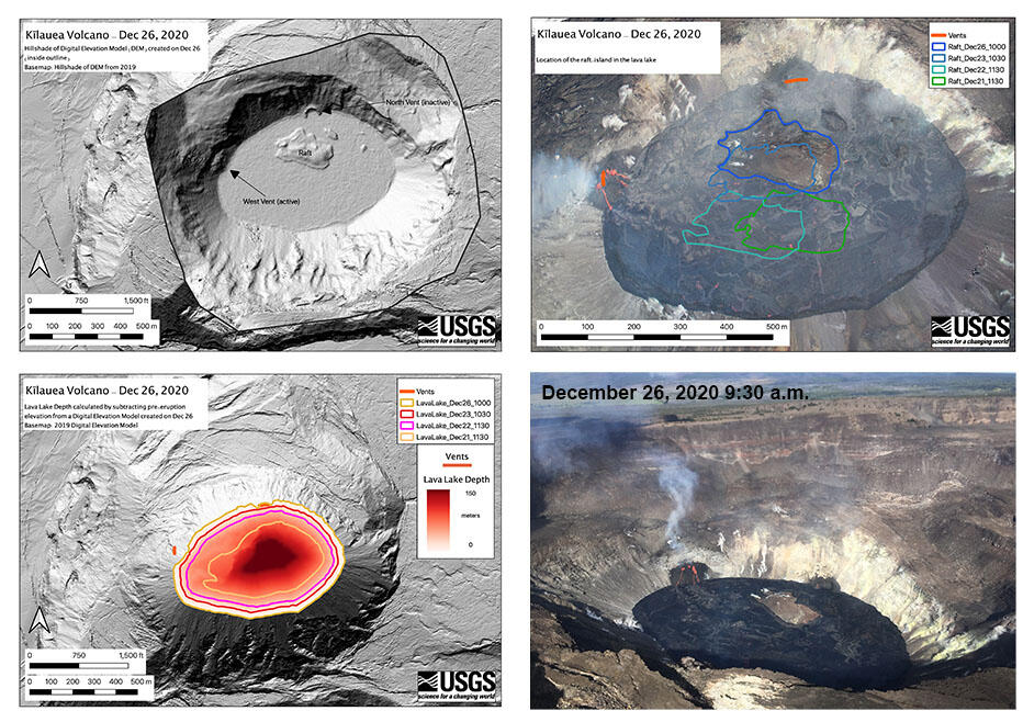
Maps made from aerial imagery taken on a December 26 overflight of Kīlauea Volcano's summit at approximately 10:00 a.m. HST. The upper left map is a Digital Elevation Model (DEM) of the lava lake with the island (raft) near the northern lake margin. The inactive northern fissure vent and active western vent are labeled. The map in the upper right shows the migration of the island (raft) over time between December 21–26. The lower left map used the December 26 DEM to calculate the lava lake depth, which has filled the bottom of Halema'uma'u crater by approximately 177 m (581 ft) of lava. USGS maps by B. Carr. The lower right photo was taken during the December 26 overflight at approximately 9:30 a.m. HST by M. Patrick.
Sources/Usage
Public Domain.