
Density of Unplugged Orphaned Wells in the Northeastern U.S.
By Pennsylvania Water Science Center
December 2022 (approx.)
Detailed Description
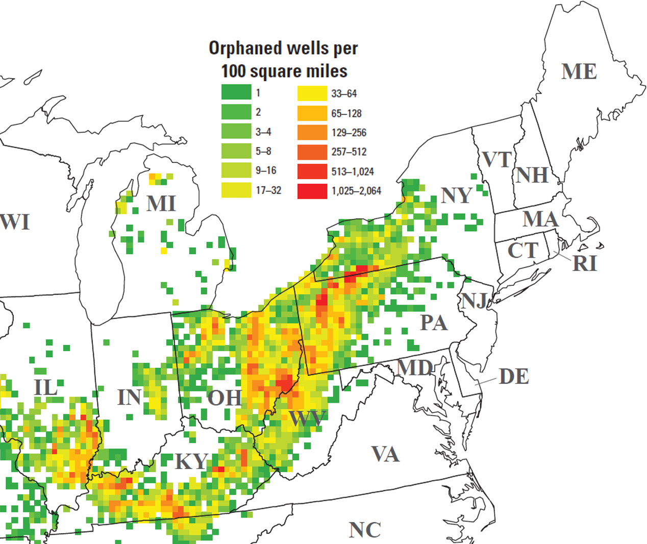
Map of the northeastern United States indicating the well density per 100 square mile grid cell of unplugged orphaned wells included in the documented orphaned oil and gas well (DOW) dataset. Note the exponential scale of the coloring scheme used to preserve detail across both lower and higher well densities. (detail of Figure 2 in Merrill, M.D., Grove, C.A., Gianoutsos, N.J., and Freeman, P.A., 2023, Analysis of the United States documented unplugged orphaned oil and gas well dataset: U.S. Geological Survey Data Report 1167, 10 p., https://doi.org/10.3133/dr1167.)
Sources/Usage
Public Domain.