
Distribution of Earth Observing-1 (EO-1) Hyperion Hyperspectral
Detailed Description
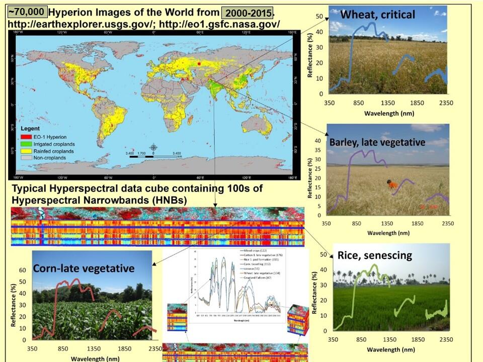
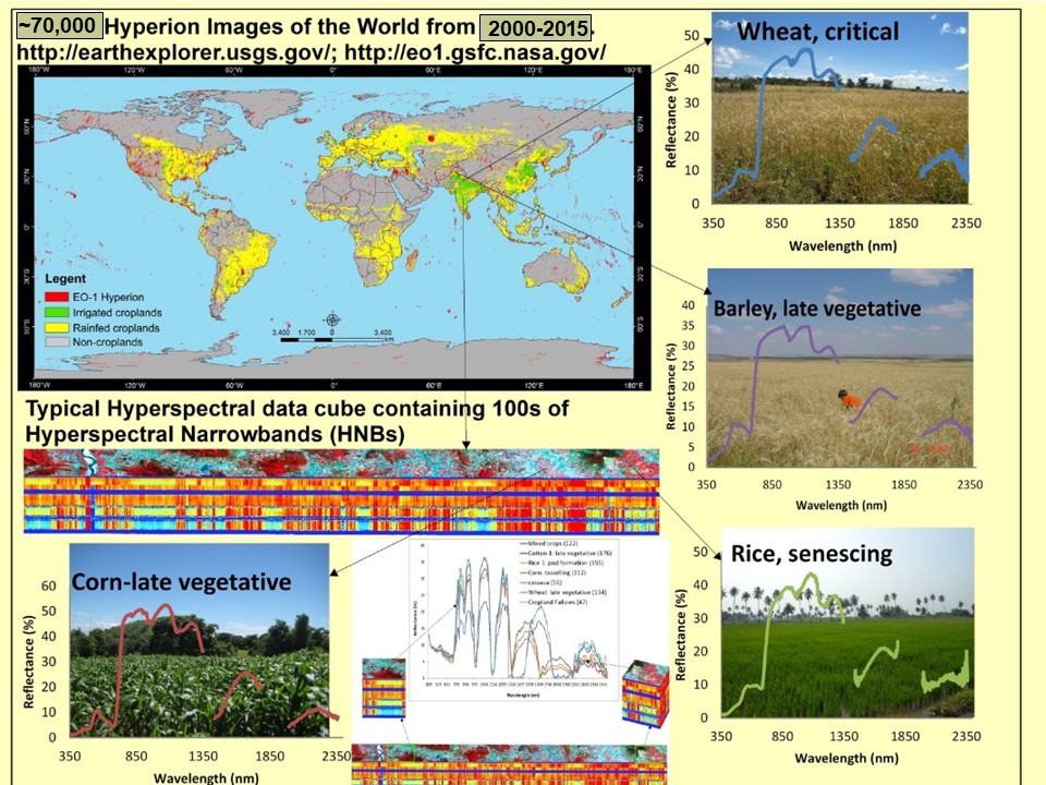
Figure 6: There are some 70,000+ images from the 2001-2015 time-period spread across the world. These images provide a rare opportunity to conduct pioneering research using hyperspectral data. These images are used to develop the Global Hyperspectral Imaging-Spectral Library of Agricultural Crops (GHISA). The spectral signature that can be extracted from the hyperspectral images is illustrated for some leading world crops in this image. (Thenkabail et al. 2014)
Sources/Usage
Courtesy: Prasad Thenkabail
Thenkabail, P.S., Gumma, M.K., Teluguntla, P., and Mohammed, I.A., 2014. Hyperspectral Remote Sensing of Vegetation and Agricultural Crops. Highlight Article. Photogrammetric Engineering and Remote Sensing. 80(4): 697-709. IP-052042.
Related

Global Hyperspectral Imaging Spectral-library of Agricultural-Crops & Vegetation (GHISA)
This webpage showcases the key research advances made in hyperspectral remote sensing of agricultural crops and vegetation over the last 50 years. There are three focus areas:
Related
Global Hyperspectral Imaging Spectral-library of Agricultural-Crops & Vegetation (GHISA)
This webpage showcases the key research advances made in hyperspectral remote sensing of agricultural crops and vegetation over the last 50 years. There are three focus areas: