
DUNEX beach profile survey

Detailed Description
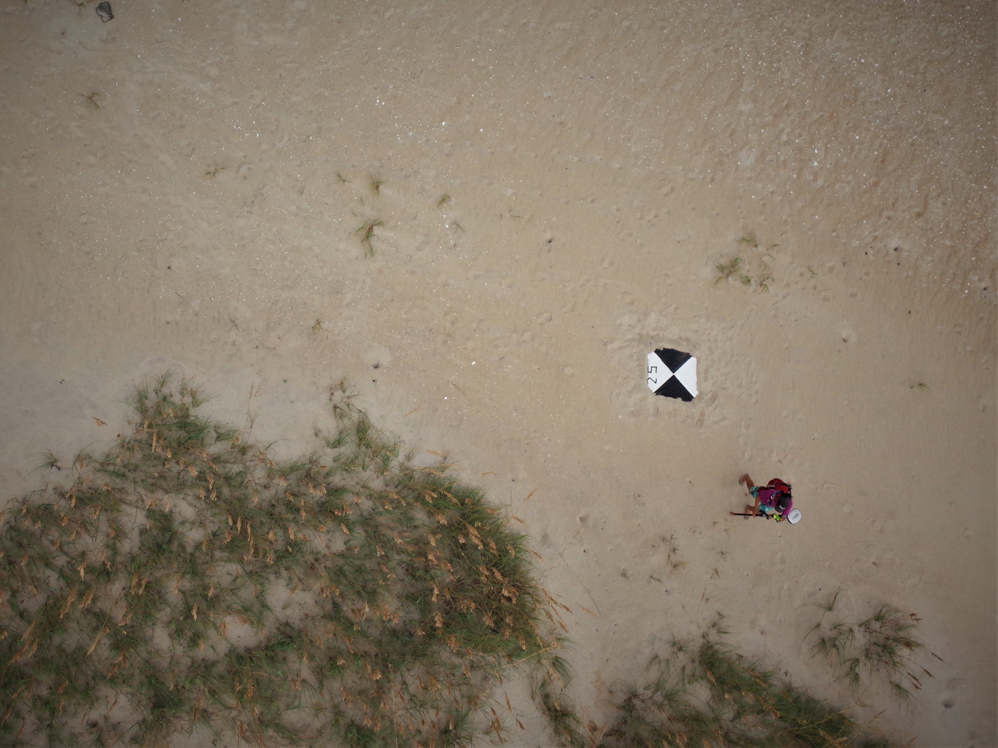
Overhead image collected by a helikite of field work being conducted in the Outer Banks of North Carolina. An alternative to uncrewed aerial systems (UAS; commonly known as 'drones'), USGS scientists use helikites equipped with cameras to collect imagery of the coastline. The pictures collected by these helium-powered kite-balloons are used to create a digital elevation model with structure- from-motion techniques. Here, Jin-Si Over of the Woods Hole Coastal and Marine Science Center uses a mobile Global Positioning System (GPS) unit to record beach elevations. The black and white ground control target nearby is used for photo rectification with aerial imagery collected by the helikite.
These surveys are being conducted as part of the are part of the DUring Nearshore Event eXperiment (DUNEX) project. DUNEX is a multi-agency, academic, and non-governmental organization collaborative community experiment designed to study nearshore coastal processes during storm events. USGS' participation in DUNEX will contribute new measurements and models that will increase our understanding of storm impacts to coastal environments, including hazards to humans and infrastructure and changes in landscape and natural habitats.
Sources/Usage
Public Domain.