
Earthquake Map for M7.1 Earthquake
Detailed Description
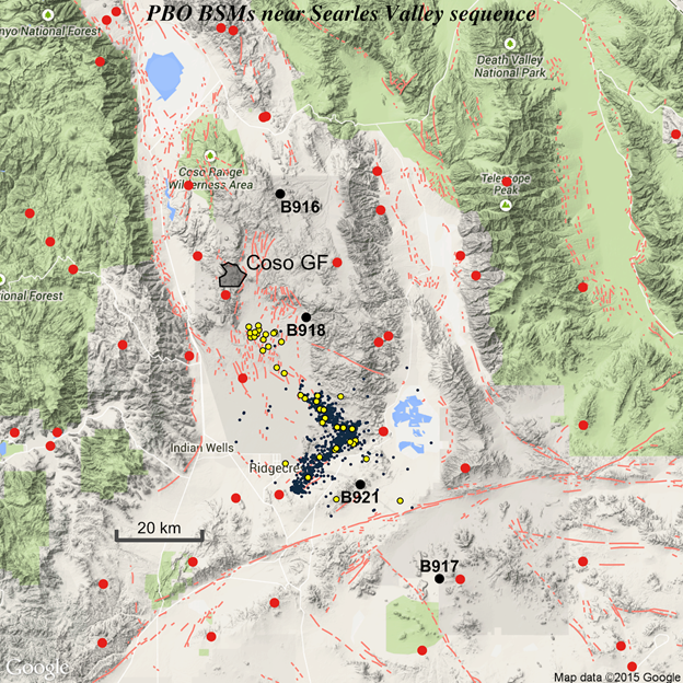
Current earthquake sequence (yellow; preliminary) overlain on foreshocks (blue; e.g., from M6.4 on). Filled polygon shows Coso Geothermal Field. Black circles show Plate Boundary Observatory borehole strainmeter locations. Red circles show GPS stations.
Sources/Usage
Public Domain.