
Elevation difference maps of Assateague Island, Virginia
Detailed Description
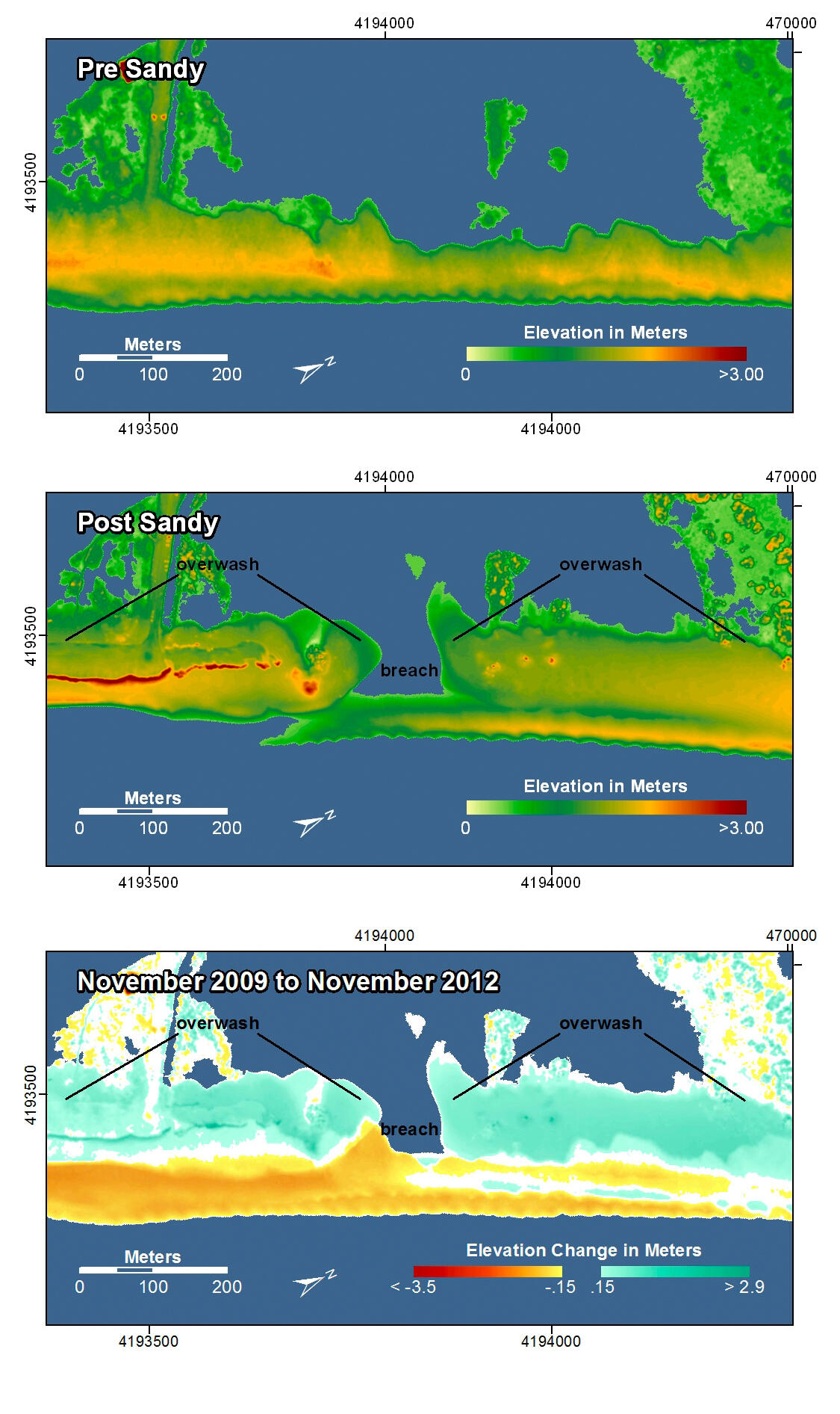
Chincoteague National Wildlife Refuge, Assateague Island, Vriginia. The pre-storm map shows that this part of the island is very low-lying and narrow and has been overwashed by earlier storms. During Hurricane Sandy, not only was there extensive overwash and deposition, but an island breach occurred, cutting the island in two. In the post-storm map there is evidence that the breach is beginning to fill in naturally which is not evident in the photo comparisons. To the left of the breach (south), road crews have pushed sand off the roadway into a line of piled sand.
In the pre- and post-storm elevation maps, orange and red colors indicate higher elevations while yellow and green colors indicate lower elevations. In the elevation difference maps, red colors indicate erosion such as shoreline retreat, and blue-green colors indicate accretion, such as overwash deposits where waves and surge have moved sand landward. Maps are oriented with the Atlantic Ocean on the bottom.