
Elevation difference maps of Long Branch, New Jersey
By St. Petersburg Coastal and Marine Science Center
2012 (approx.)
Detailed Description
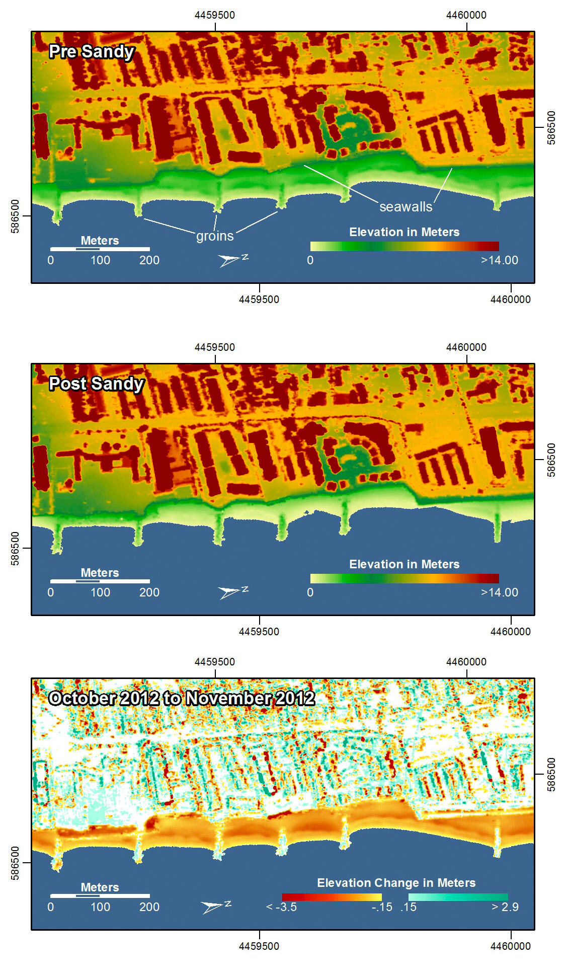
Pre-storm elevation map, post-storm elevation map, and elevation difference map of Long Branch, New Jersey. Storm surge, waves and currents eroded the beach at this location. The erosion exposed several types of erosion control structures, such as rock walls, concrete walls and groins.
In the pre- and post-storm elevation maps, orange and red colors indicate higher elevations while yellow and green colors indicate lower elevations. In the elevation difference maps, red colors indicate erosion such as shoreline retreat, and blue-green colors indicate accretion, such as overwash deposits where waves and surge have moved sand landward. Maps are oriented with the Atlantic Ocean on the bottom.
Sources/Usage
k