
Elevation difference maps of Mantoloking, New Jersey
Detailed Description
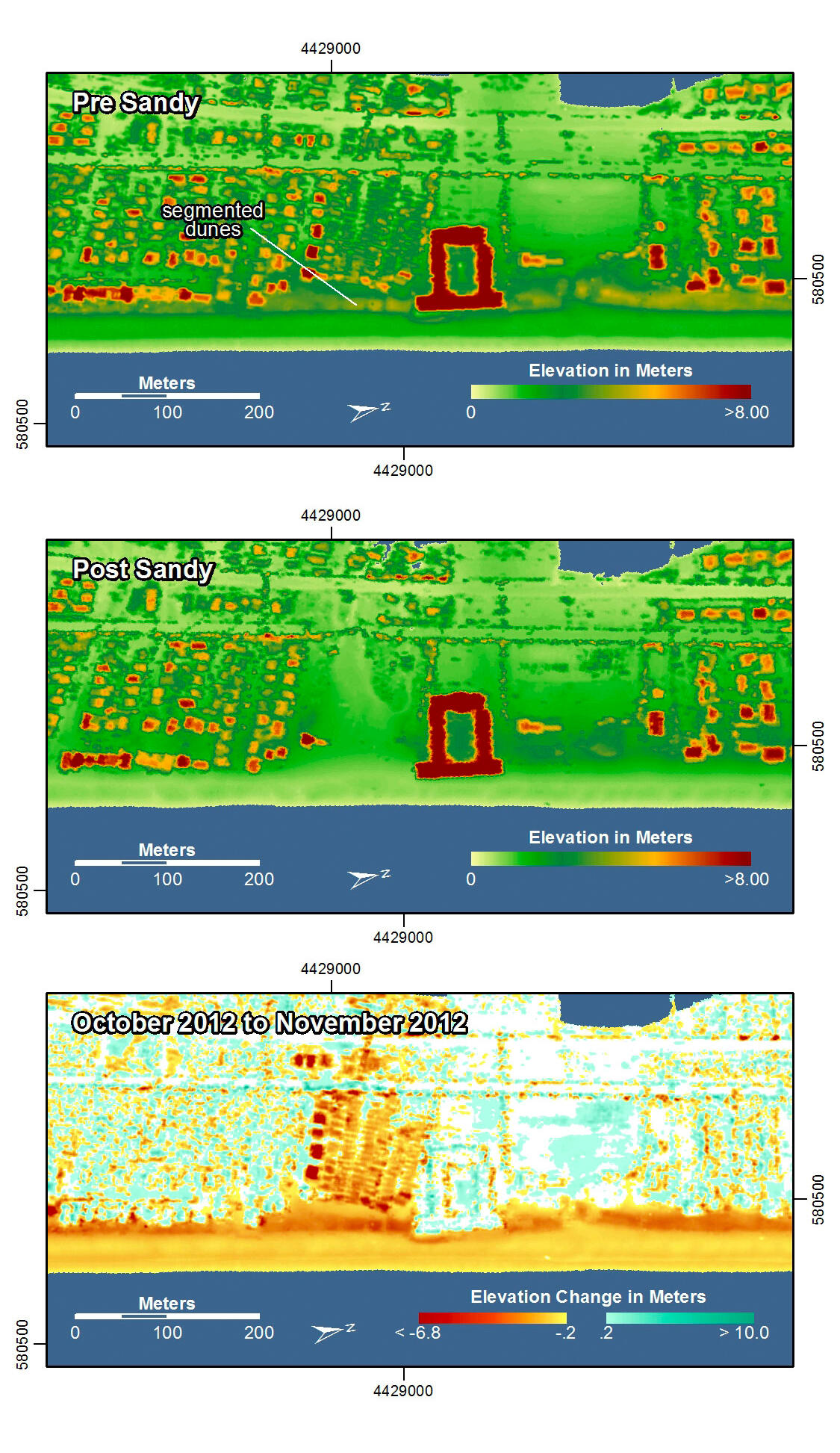
Pre-storm elevation map, post-storm elevation map, and elevation difference map of Mantoloking, New Jersey. Lightly vegetated dunes, segmented by pathways, existed at this location prior to Hurricane Sandy. Storm surge and waves overwashed the dunes, flattening them and destroying many buildings behind them. Overwash deposits remained on roads and between houses.
In the pre- and post-storm elevation maps, orange and red colors indicate higher elevations while yellow and green colors indicate lower elevations. In the elevation difference maps, red colors indicate erosion such as shoreline retreat, and blue-green colors indicate accretion, such as overwash deposits where waves and surge have moved sand landward. Maps are oriented with the Atlantic Ocean on the bottom.
Sources/Usage
k