
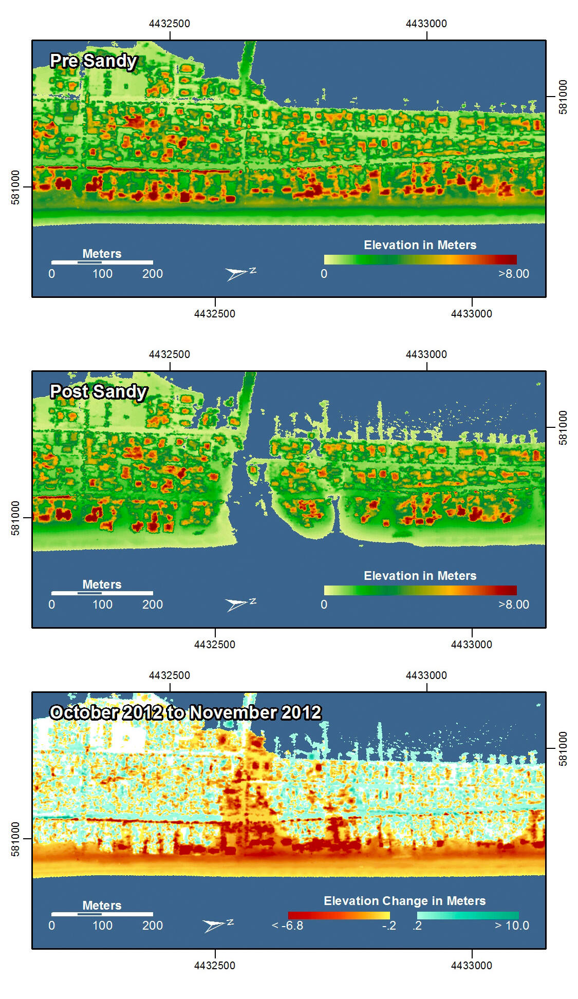
Elevation difference maps of Mantoloking, New Jersey
Detailed Description
Pre-storm elevation map, post-storm elevation map, and elevation difference map of Mantoloking, New Jersey. At this location, storm surge and waves eroded the beach and dunes and a breach cut through the approximately 250 meter wide island, destroying houses and roads. Overwash deposition occurred in many areas. Note that the lidar survey was conducted immediately after the storm before the breach had been filled, whereas the photo survey was conducted a few days later after the breach was filled.
In the pre- and post-storm elevation maps, orange and red colors indicate higher elevations while yellow and green colors indicate lower elevations. In the elevation difference maps, red colors indicate erosion such as shoreline retreat, and blue-green colors indicate accretion, such as overwash deposits where waves and surge have moved sand landward. Maps are oriented with the Atlantic Ocean on the bottom.
Sources/Usage
k