
Elevation difference maps of Rodanthe, North Carolina
Detailed Description
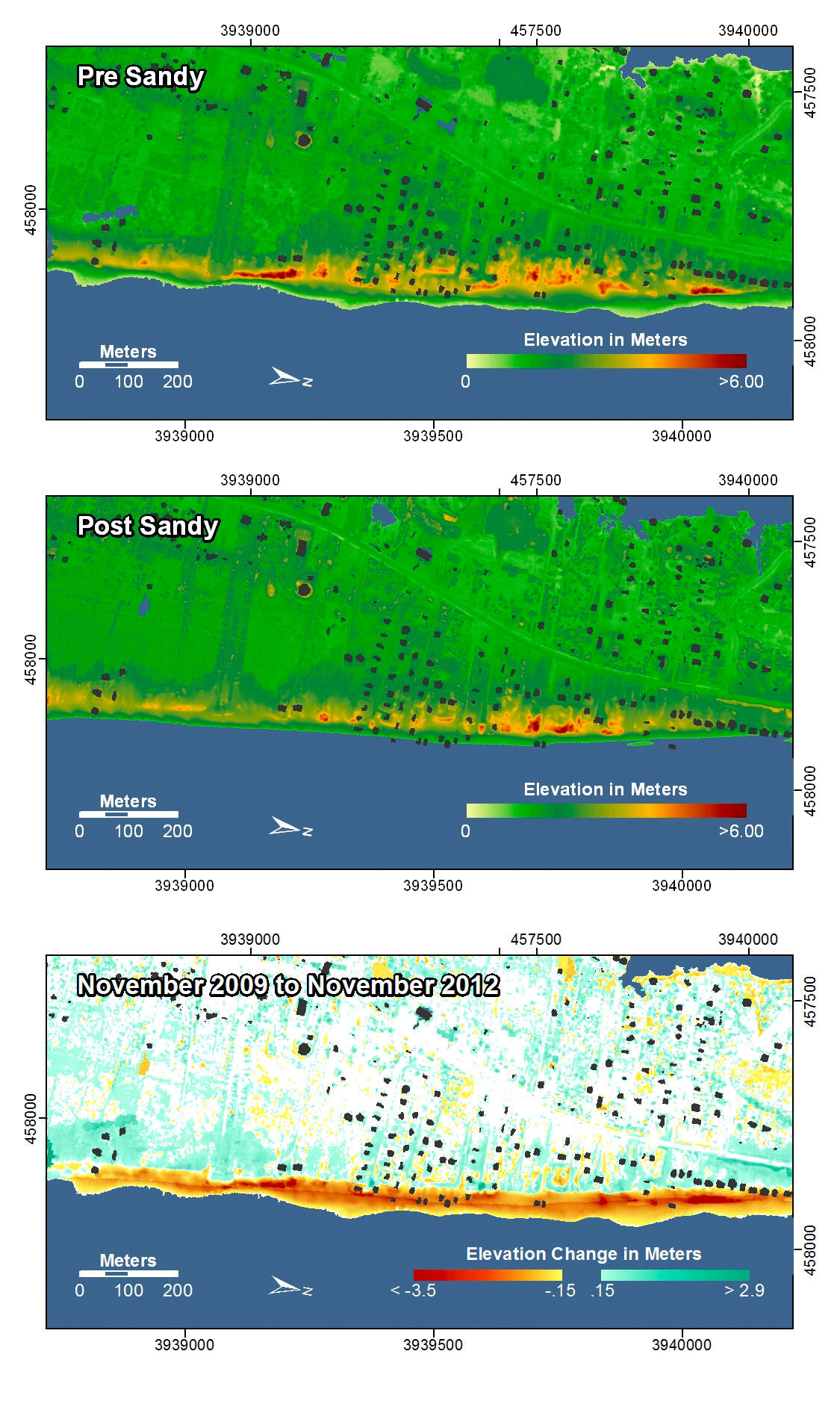
Rodanthe, North Carolina. Prior to Hurricane Sandy several houses sat on top of or just seaward of the dunes or highest elevations on this part of the island. The relatively high elevation of the houses has been identified and marked with black shading on the maps. After Sandy, the beach and dunes have eroded and the shoreline has moved landward, leaving some of the houses more vulnerable to future storms. Storm surge and waves produced overwash that deposited sand on the coastal roads.
In the pre- and post-storm elevation maps, orange and red colors indicate higher elevations while yellow and green colors indicate lower elevations. In the elevation difference maps, red colors indicate erosion such as shoreline retreat, and blue-green colors indicate accretion, such as overwash deposits where waves and surge have moved sand landward. Maps are oriented with the Atlantic Ocean on the bottom.