



Examples of poultry facility exposure by GPS-marked Canada Geese (CANG) and Greater Snow Geese (GSGO)
By Chesapeake Bay Activities
2022 (approx.)
Detailed Description
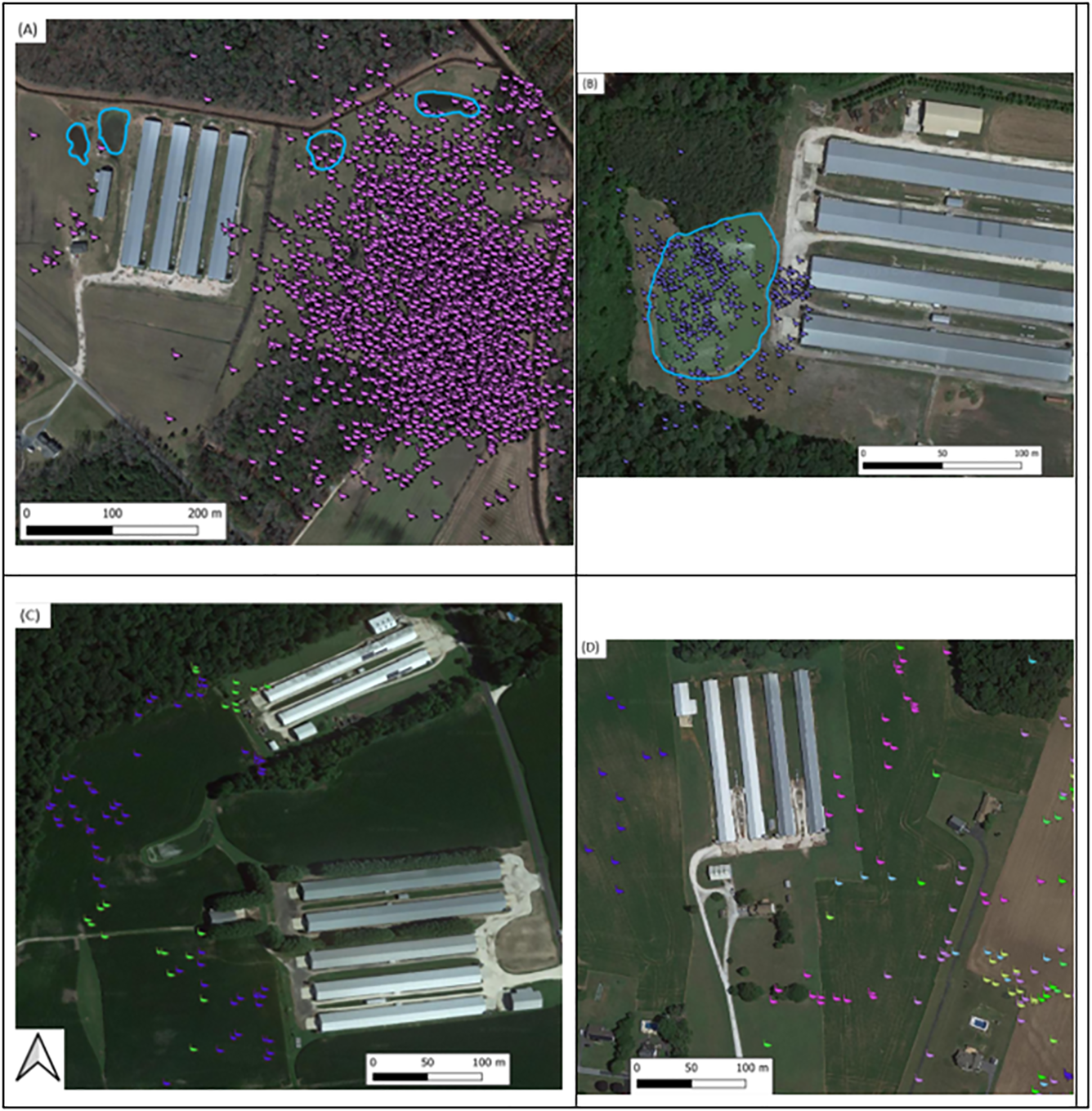
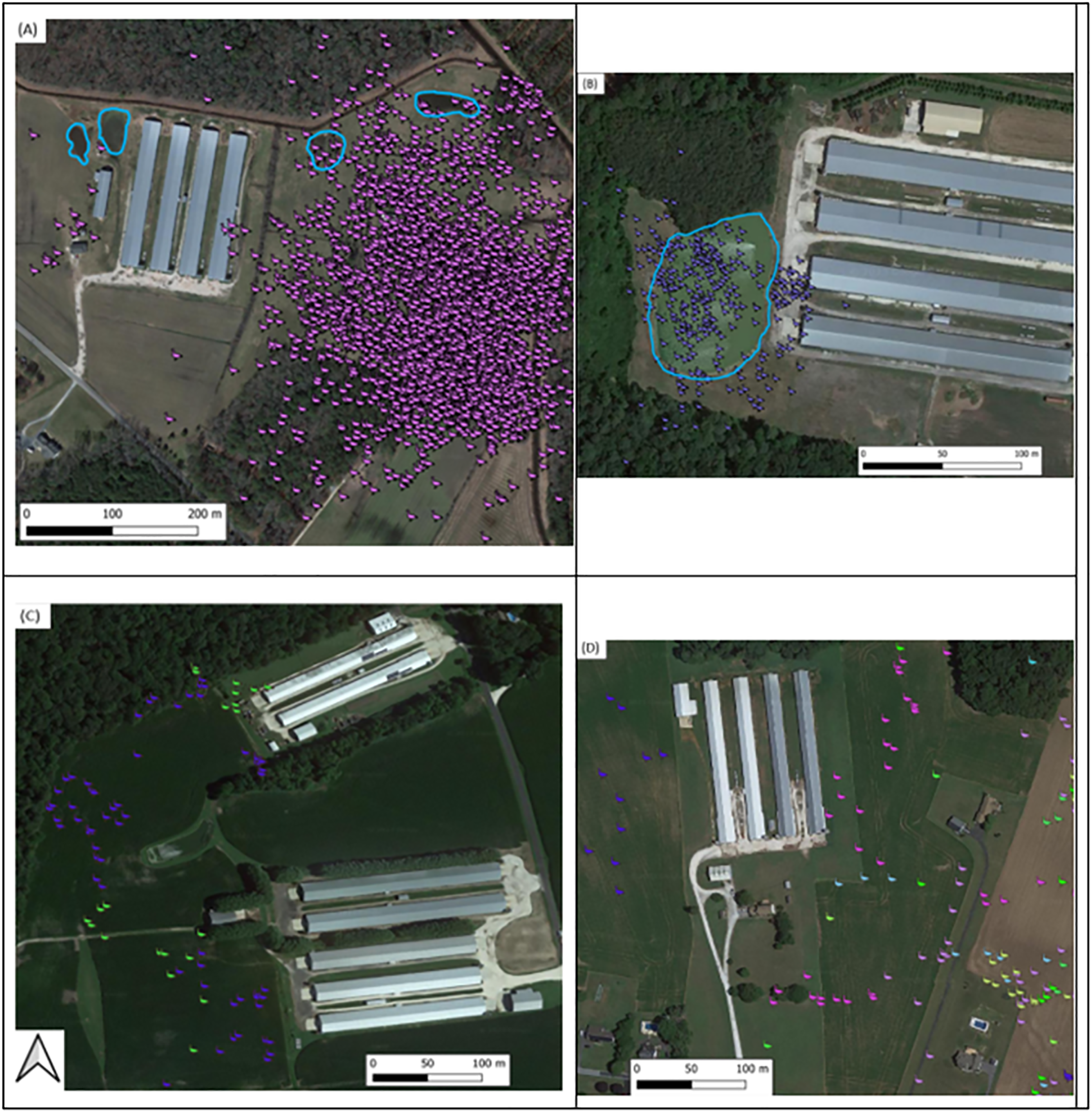
Examples of poultry facility exposure by GPS-marked Canada Geese (CANG) and Greater Snow Geese (GSGO). Four cases of poultry facility exposure and adjacent property use by wintering Canada Geese (CANG) and Greater Snow Geese (GSGO) in the Delmarva Peninsula during the winter of 2022-2023 (A-D). Two cases included facilities associated with farm ponds (A-B) (blue outline). Each colored point represents 5 minutes of exposure time for a distinct individual (A = CANG, n = 1, purple; B = GSGO, n = 1, blue; C = GSGO, n = 2, yellow/blue; D = GSGO, n = 4, blue/pink/green/yellow). Background imagery from the U.S. Department of Agriculture National Agriculture Imagery Program (NAIP).
Sources/Usage
Public Domain.
Related

Exploring Wild Bird Movements to Understand Avian Influenza Risk for Poultry Farms on the Delmarva Peninsula
A recent collaborative study involving USGS, University of Delaware, University of California Davis, and Canadian colleagues used GPS tracking to learn how Canada Geese and Snow Geese use the landscape when wintering on the Delmarva Peninsula. These data were then used to understand location-based risk factors for the spread of Highly Pathogenic Avian Influenza Virus (HPAIV) to commercial poultry...
Related
Exploring Wild Bird Movements to Understand Avian Influenza Risk for Poultry Farms on the Delmarva Peninsula
A recent collaborative study involving USGS, University of Delaware, University of California Davis, and Canadian colleagues used GPS tracking to learn how Canada Geese and Snow Geese use the landscape when wintering on the Delmarva Peninsula. These data were then used to understand location-based risk factors for the spread of Highly Pathogenic Avian Influenza Virus (HPAIV) to commercial poultry...