
Figure 4 graphic for NPPSD

Detailed Description
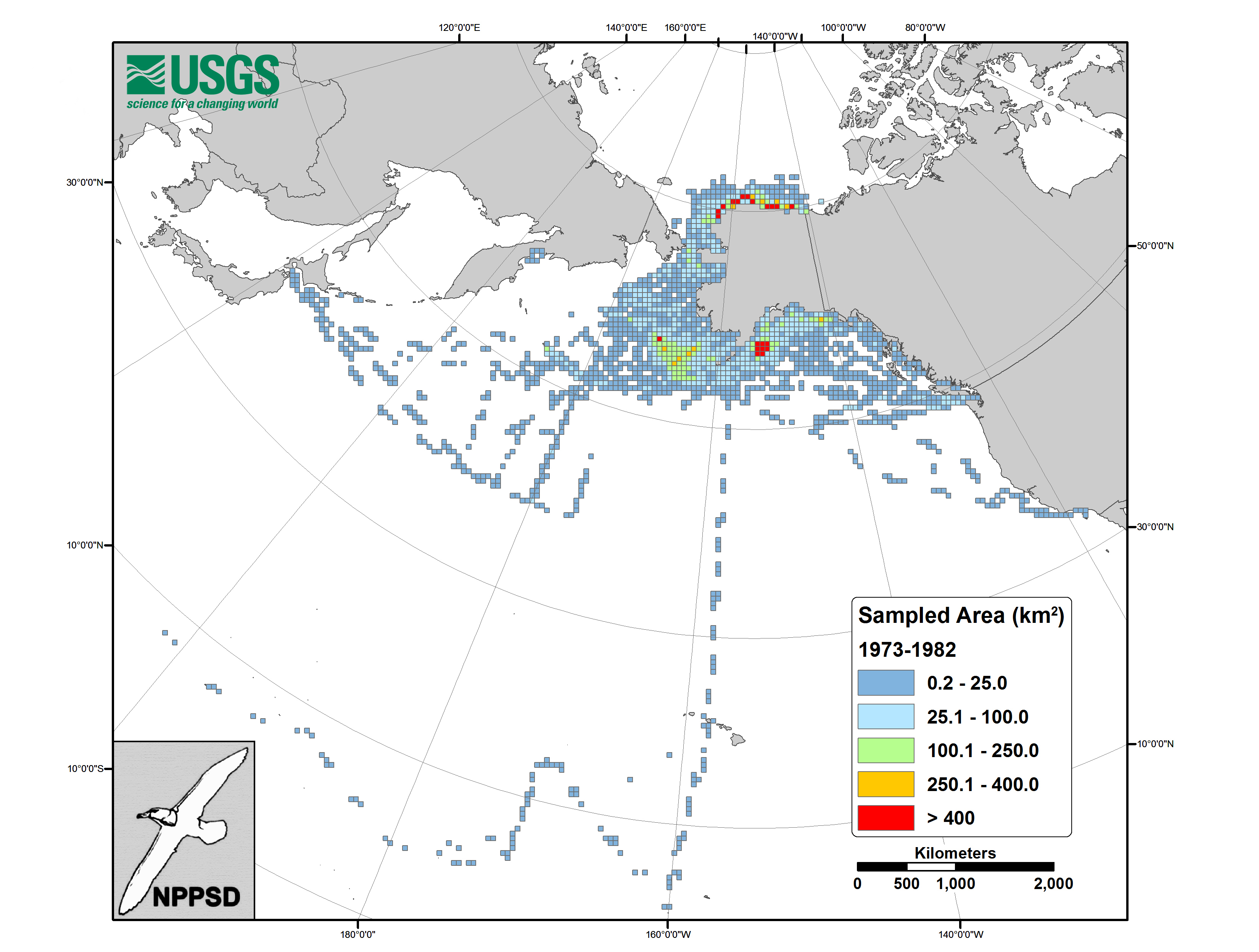
Map showing area sampled during time periods 1973–1982. Cells are 50 × 50 km. Seabird survey observations from 1973 - 1982 used to create the first pelagic seabird database.
Sources/Usage
Public Domain.
U.S. Geological Survey
Related

Use and History of the North Pacific Pelagic Seabird Database (NPPSD)
Data on the distribution and abundance of seabirds at sea have been used for many decades to assist in understanding the marine ecology of seabirds away from their breeding colonies, measure population status and trends, assess the impact of human activities on ocean habitats and fish stocks, and to identify critical marine habitats for seabirds.
Related
Use and History of the North Pacific Pelagic Seabird Database (NPPSD)
Data on the distribution and abundance of seabirds at sea have been used for many decades to assist in understanding the marine ecology of seabirds away from their breeding colonies, measure population status and trends, assess the impact of human activities on ocean habitats and fish stocks, and to identify critical marine habitats for seabirds.