
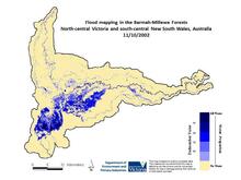
Flood mapping in 2002 in the Barmah-Millewa forests

Detailed Description
Flood mapping in 2002 in the Barmah-Millewa forests, north-central Victoria and south-central New South Wales, Australia. Courtesy of the Victoria Department of Environment and Primary Industries.