
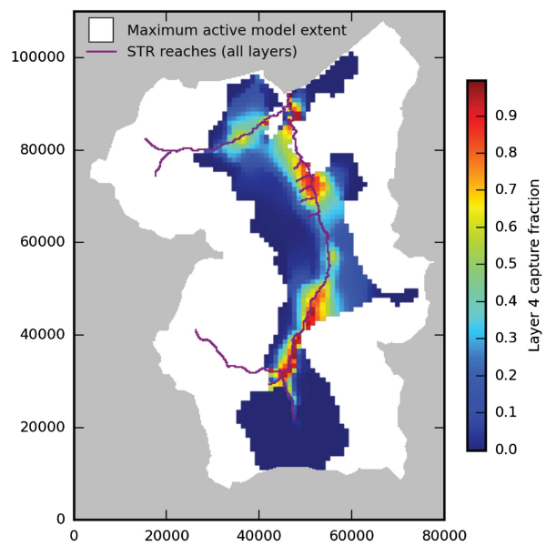
FloPy Map of Computed Capture Fraction of Water

Detailed Description
FloPy generated map showing the computed capture fraction of water from head‐dependent boundaries as a function of well location in the Upper San Pedro Basin model layer corresponding to the lower basin fill after 10 years of pumpage. The maximum areal extent of the active model domain and the location of stream boundary conditions in all model layers are also shown.
Sources/Usage
Public Domain.