
General Surface Ruptures Based on Field and Satellite Data Ridgecrest
Detailed Description
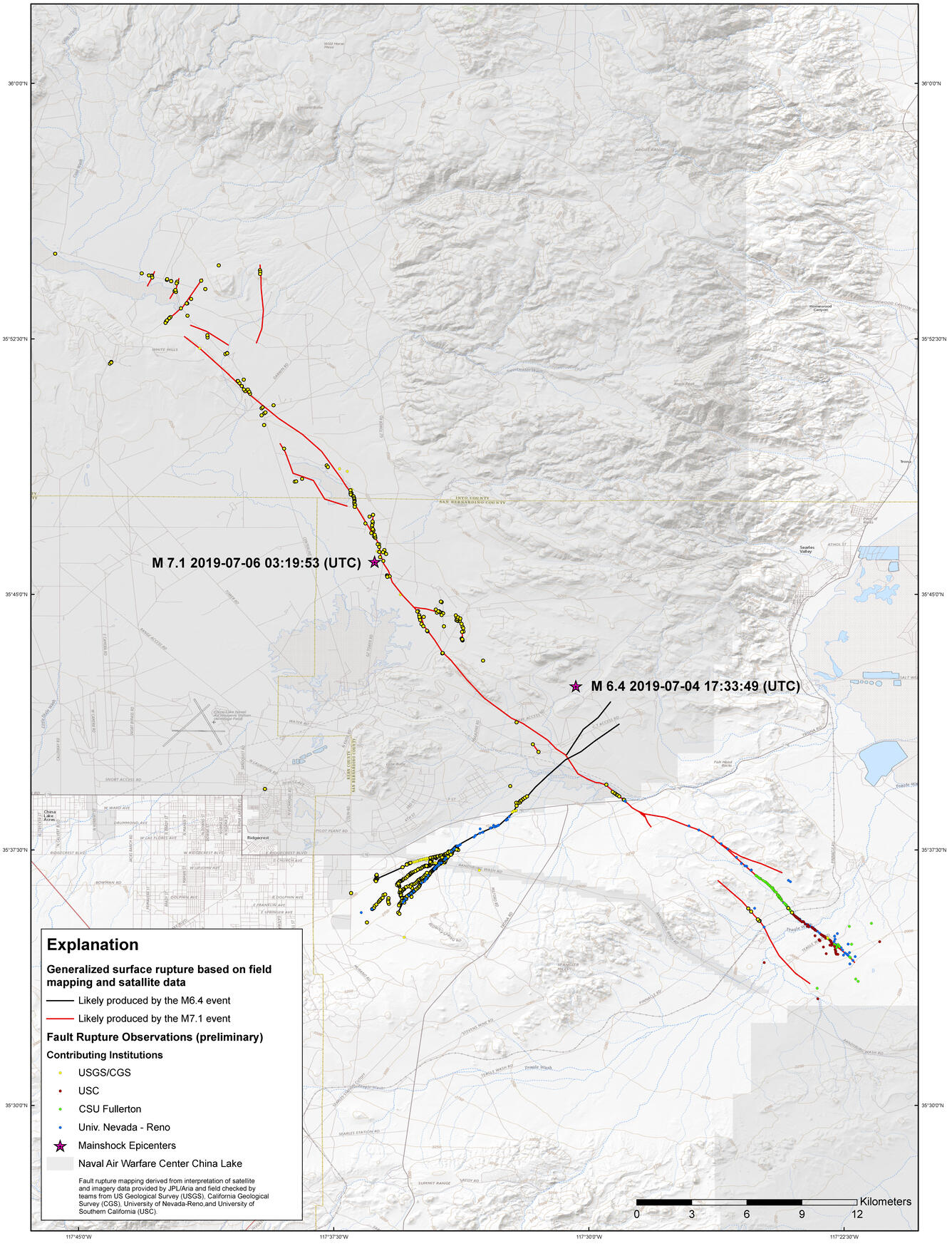
General surface rupture based on field mapping and satellite data as of July 11, 2019. Ruptures from the magnitude 6.4 event are shown in black and blue, and ruptures from the magnitude 7.1 event are shown in red and green. Circles indicate where scientists have visited the fault surface rupture.
Sources/Usage
Public Domain.