
Geologic Map and Borehole Stratigraphy of Hinkley Valley and Vicinity,

Detailed Description
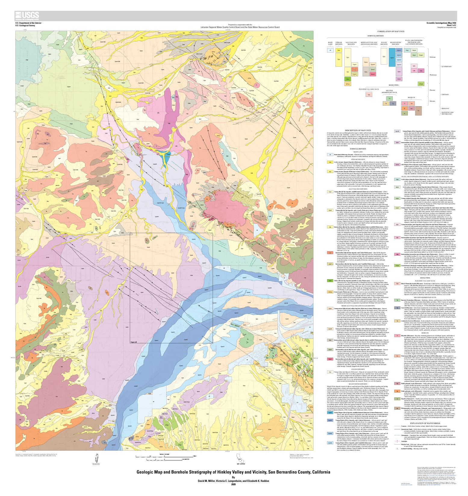
Hinkley Valley, in the central to western Mojave Desert of southeastern California, has a long historical record owing to its position as a crossroads for rail and road traffic and its position adjacent to the Mojave River. Subflow in the Mojave River provided groundwater recharge that maintained water consumption and demand by way of shallow wells for local agriculture in the valley. Its crossroads position led to construction of several power-transmission lines, pipeline, and communications cable routes that transect Hinkley Valley. One of these, a natural gas pipeline and its associated compressor station, was the locus of hexavalent chromium, Cr(VI), released into, and consequent contamination of, groundwater. Understanding the movement and fate of the contaminants is a complex hydrologic and geochemical problem. Geologic mapping of the Hinkley Valley area provides framework elements for use in resolving this problem.
Sources/Usage
Public Domain.