
Geomorphic response to breaching of Condit Dam, White Salmon River, WA
By Volcano Hazards Program
1905 (approx.)
Detailed Description
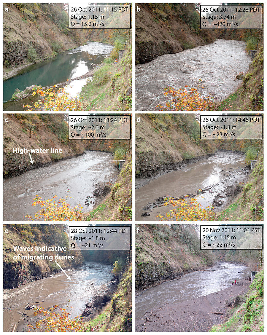
White Salmon River (Washington) at USGS gauge site, 2.3 km downstream of Condit Dam, looking downstream: (a) 53 min before breaching; (b) 20 min after breaching, at discharge peak; (c) 76 min after breaching, at peak sediment concentration, with high water line evident; (d) ~2.5 h after breaching, discharge has returned to background and sediment concentration is falling; (e) 2 days after breaching, when channel has aggraded and migrating dunes indicate substantial sandy bed-material transport; and (f) 25 days after breaching, showing bar emergence.