
Gold King Mine Pond Edge
Detailed Description
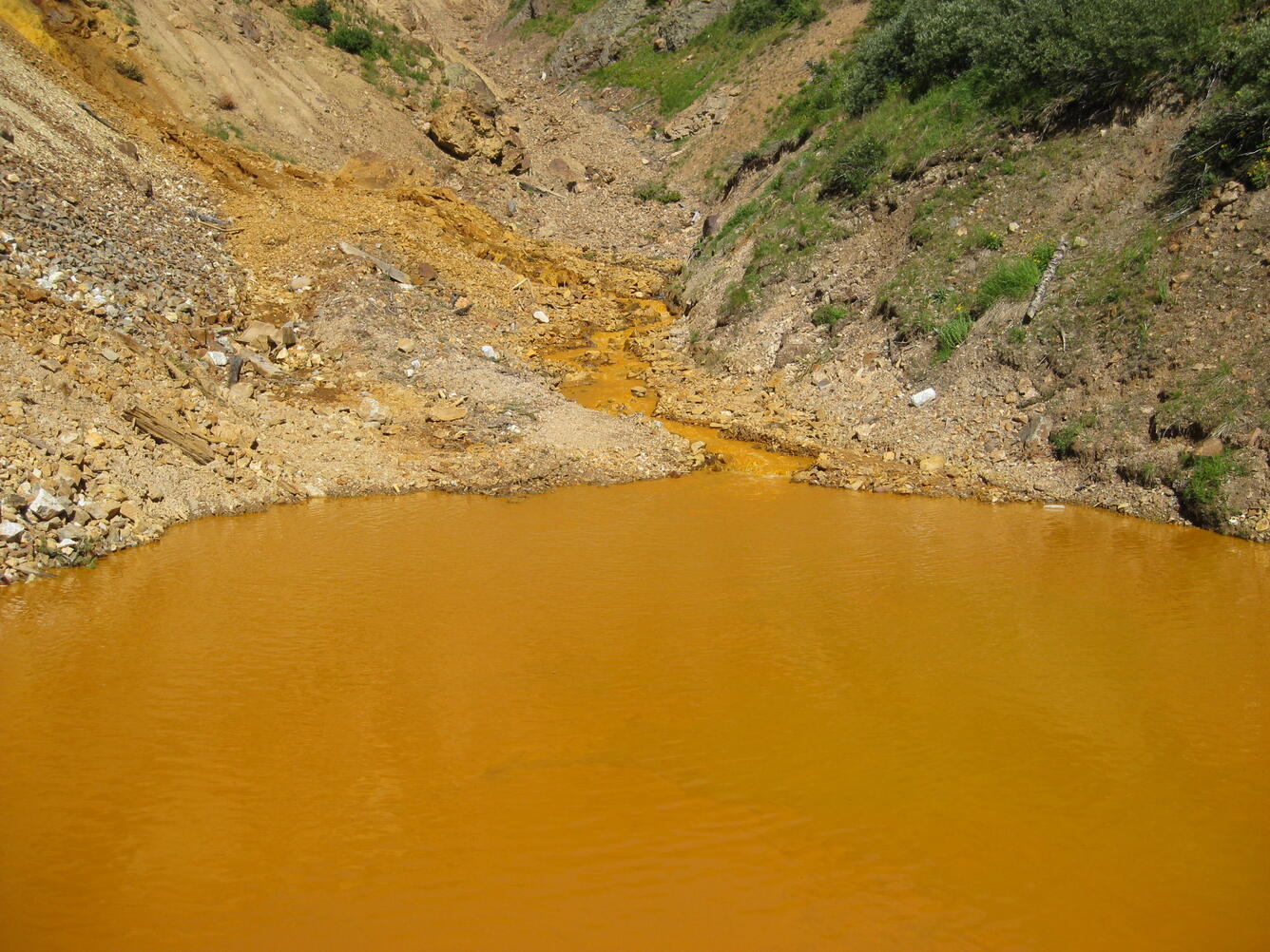
View of pond in North Fork of Cement Creek that receives the water from the Gold King Mine portal and native flow in North Fork Cement Creek, looking upstream, very little to no native flow is visible. Latitude 37.89401, Longitude -107.63821.
Sources/Usage
Public Domain.