
Gregory fault vein and mine with annotations, Colorado

Detailed Description
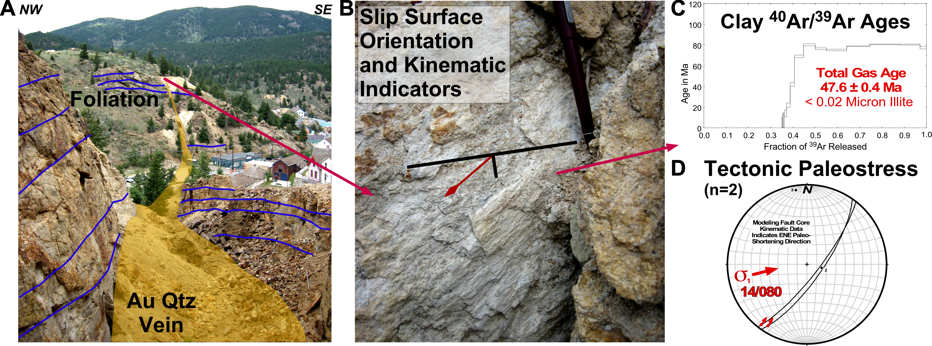
Gregory fault vein and mine in Central City, Colorado (photos, annotations, and model by Jonathan Caine, USGS. Also see Caine et al., 2006, 2010). A) The Gregory vein and surrounding clay alteration (yellow) cutting layering in the host rock foliation and layering (blue). B) Detail view of clay-rich strike slip slickensides dated using (C) argon geochronology and (D) equal-area plot with a model of the orientation of the ancient plate tectonic forces (σ = stress) that controlled the location and orientation of the fault vein.
References
Caine, Jonathan S., Nelson, Eric P., Beach, Steven T., and Layer, Paul W., 2006, Structural Fabrics, Mineralization, and Laramide Kinematics of the Idaho SpringsRalston Shear Zone, Colorado Mineral Belt and Central Front Range Uplift: The Mountain Geologist, v.43, no. 1 (January), p. 1-24, 11 figs., 3 tables, 1 appendix.
Caine, J.S., and Bove, D.J., 2010, Rock Geochemistry and Mineralogy from Fault Zones and Polymetallic Fault Veins of the Central Front Range, Colorado: U.S. Geological Survey Data Series 492, Report: iv, 6 p.; Tables (XLS, PDF), https://doi.org/10.3133/ds492.
Sources/Usage
Public Domain.
Related
Geophysical and Geological Characterization of Mineral Deposit Localization in the Colorado Mineral Belt and Surrounding Lithosphere: Structural Geology
Related