
Highway 83 Bypass
Detailed Description
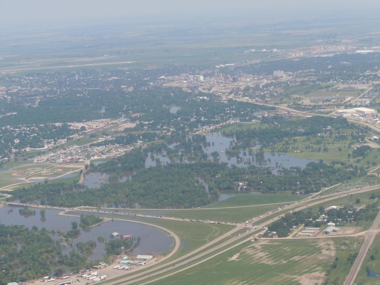
Looking east into Minot, ND being flooded by the Souris River. To the left of the photo there is the Highway 83 Bypass and to the bottom of the photo there is Highway 42.
Photo taken by USGS personnel on a Civil Air Patrol flight.
Sources/Usage
Public Domain.