
Historic photograph taken in 1889 by Franklin Nims during the Stanton Expedition of the Glen Canyon Dam site, well before it was built on the Colorado River

Detailed Description
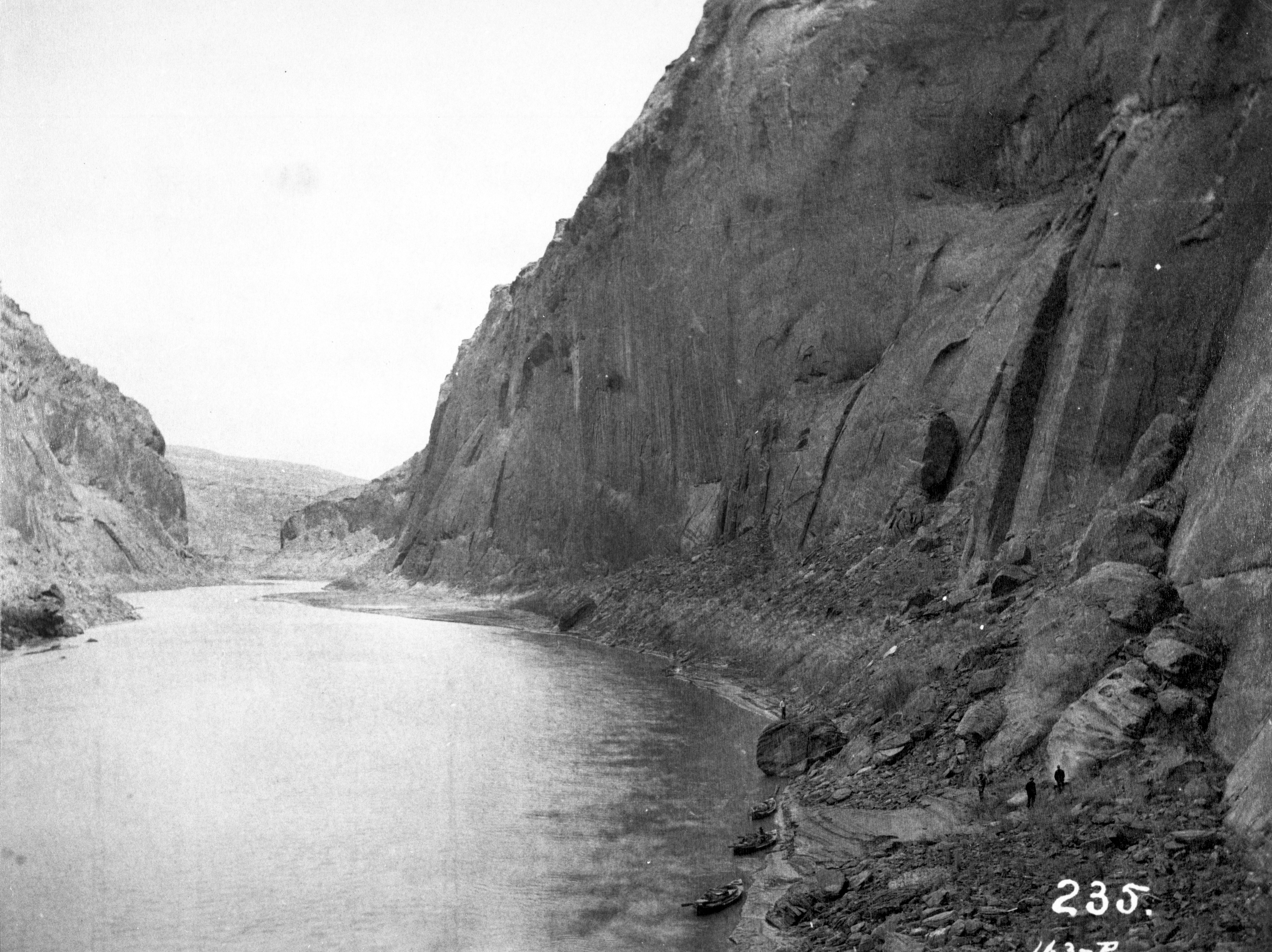
A historic image taken on December 23, 1889 of the Colorado River, River Mile Mile -14.7, of the site where Glen Canyon Dam would later be built. The view is taken upstream from river left in 1889 by Franklin Nims during the Stanton Expedition. Photo credit: Franklin A. Nims, original courtesy of The National Archives, 57-RS-235, public domain. Stake (camera point) s2638 in the SBSC’s Southwest Repeat Photography Collection.
Excerpt of the Stanton Survey History by Robert H. Webb, USGS, public domain (from the now unavailable webpage on the subject):
In May 1889, railroad engineer Robert Brewster Stanton, in collaboration with real estate investor Frank M. Brown, began a survey of the Green and Colorado River corridors. Their goal was to construct a railroad line from Grand Junction, Colorado to San Diego, California, one that would wind at river-level through several of the Colorado River’s canyons. While that expedition ended in disaster in July after three men—one of them Brown—drowned in Grand Canyon, Stanton successfully completed the survey that winter (1889-1890). The expedition quickly discovered that conducting the survey by instrument was far too time-consuming for their allotted time, so the men turned to line-of-site photographs taken on newfangled flexible roll film (rather than the cumbersome glass plates used by their predecessors). Although the railroad project never got past the planning stages, the photographs would prove to be invaluable as the basis for repeat photography a century later. From 1989 to 1995, the USGS re-photographed nearly all of the images that the expedition’s photographers—Franklin A. Nims and, after Nims was injured and left the expedition, Stanton himself—took in both Grand and Cataract Canyons. The photographs reveal changes in desert and riparian vegetation, rapids, and beaches, as a result of both natural and human-caused processes. Many of the Grand Canyon images were published in the book “Grand Canyon, A Century of Change,” by Robert Webb, and a selection of the Cataract Canyon images appeared in “Cataract Canyon: A Human and Environmental History of the Rivers in Canyonlands,” by Robert Webb, Jayne Belnap, and John Weisheit. In 2010, the USGS re-matched many of the images, both in Grand Canyon and Cataract Canyon.
For Stanton’s crew, the objective on the morning of December 23 was not just to survey a railroad route but to reach Lee’s Ferry in time for Christmas. They knew that Warren Johnson lived at Lee’s Ferry and expected a feast, a departure from their spartan river fare. They had camped the previous night only a short distance above the current site of Glen Canyon Dam. At 8:30 am, Stanton stopped in a right-hand bend 14.7 miles upstream of Lee’s Ferry. While others surveyed the route, Nims captured this view under cloudy skies.
Sources/Usage
Public Domain.