
How Remote Sensing Was Used To Detect Soil Erosion
Detailed Description
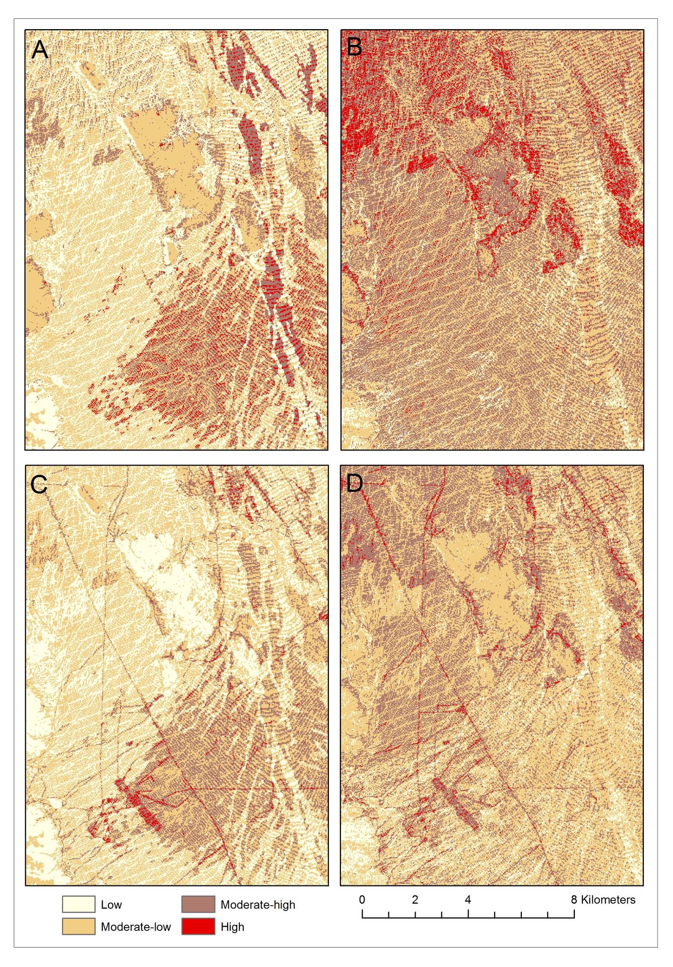
Information from satellite imagery helped to differentiate areas vulnerable to soil erosion from off-highway vehicle use. For this study we developed a “P-factor” by scaling ground measurements of soil compaction to vehicle disturbances mapped from aerial imagery. We also used NDVI to better represent the spatial complexity of vegetation cover, which helps to reduce soil erosion. This figure shows four Erosion Potential Models based on different input factors: A) land cover model with no P-factor, B) Landsat NDVI model with no P-factor, C) land cover model with P-factor, and D) Landsat NDVI model with P-factor. The models that include NDVI and P-factor data can be used by managers to better identify areas sensitive to erosion from anthropogenic land uses.
Sources/Usage
Public Domain.
Related

Soil Compaction and Erosion
Related