
Hydrologic Unit and National Hydrography Dataset Plus Medium Resolution Spatial Scales Example
Detailed Description
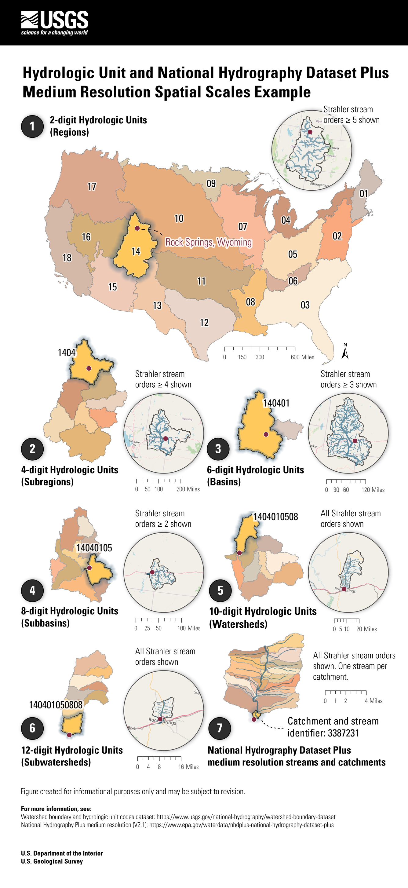
Hydrologic Unit and National Hydrography Dataset Plus Medium Resolution Spatial Scales Example
The Watershed Boundary Dataset divides and sub-divides the United States into successively smaller hydrologic units. Hydrologic units are arranged or nested within each other, from the largest geographic area (regions) to progressively smaller areas. Each hydrologic unit is identified by a unique hydrologic unit code ("HUC") consisting of two to 12 digits based on the levels of classification in the hydrologic unit system:
- 2-digit Hydrologic Units (Regions; e.g., 14)
- 4-digit Hydrologic Units (Subregions; e.g., 1404)
- 6-digit Hydrologic Units (Basins; e.g., 140401)
- 8-digit Hydrologic Units (Subbasins; e.g., 14040105)
- 10-digit Hydrologic Units (Watersheds; e.g., 1404010508)
- 12-digit Hydrologic Units (Subwatersheds; e.g., 140401050808)
The 12-digit hydrologic units define all or part of the extent of surface water drainage to a hydrologic feature. Integrated within the Watershed Boundary Dataset, and at a finer scale than the 12-digit hydrologic units, is the National Hydrography Dataset (the figure shows features from the 1:100,000 scale National Hydrography Plus v2.1 dataset, one of multiple National Hydrography Dataset products). This dataset consists of catchments and flowlines ("streams"), where there is one catchment representing the drainage area of a given stream.
This figure was created for informational purposes only and may be subject to revision.
For more information, see:
Watershed boundary and hydrologic unit codes dataset, https://www.usgs.gov/national-hydrography/watershed-boundary-dataset
National Hydrography Plus medium resolution (V2.1), https://www.epa.gov/waterdata/nhdplus-national-hydrography-dataset-plus
Sources/Usage
Public Domain.
Related

Integrated Water Availability Assessments Fundamentals
Related