
Islands in Halemaumau and Kilauea Volcano lava lake, 1917 & 2021

Detailed Description
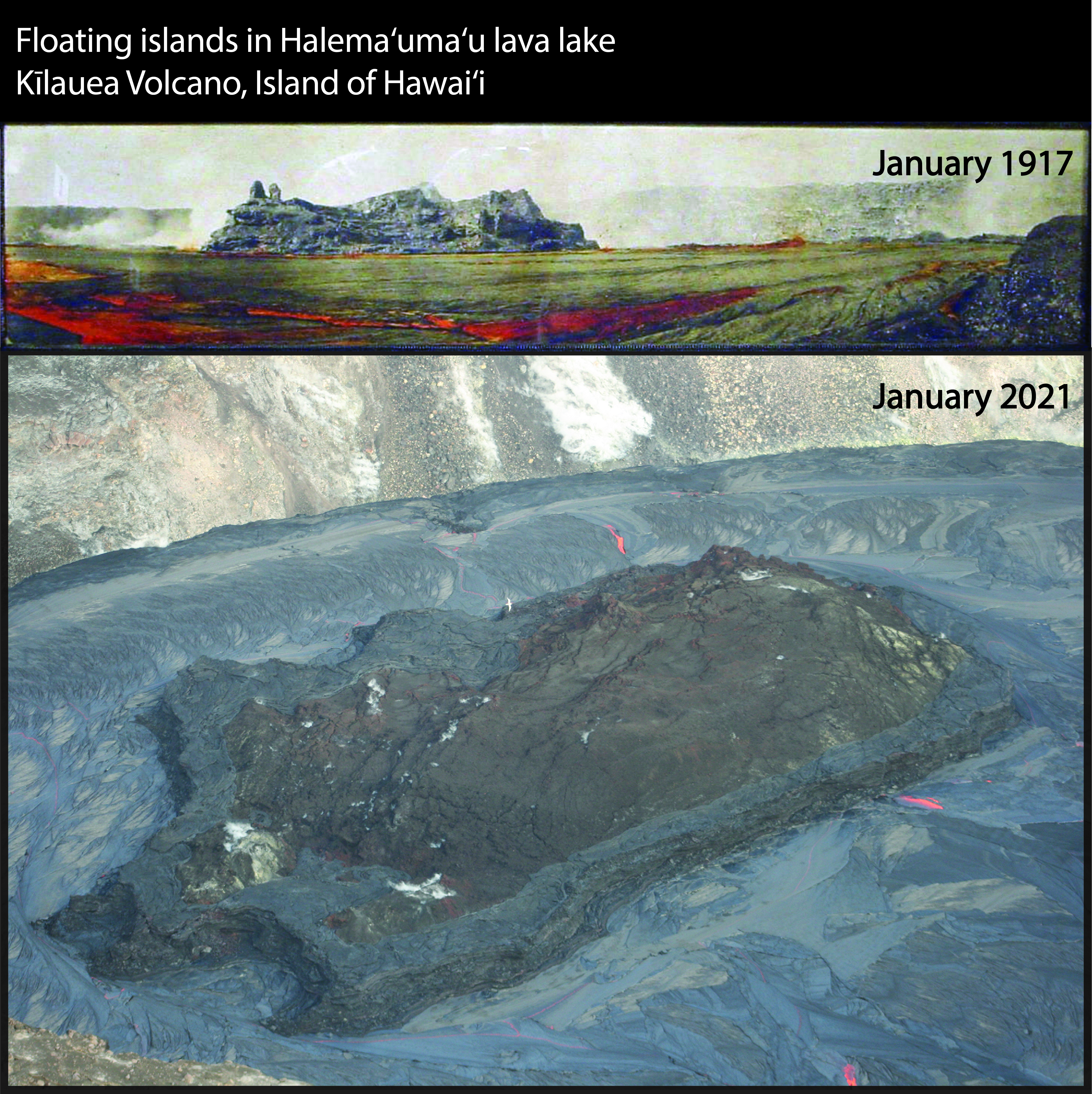
Islands have been observed in Kīlauea lava lakes for more than 100 years—some move and some are moored. These two photographs of Halemaʻumaʻu crater from 1917 (top) and 2021 (bottom) show islands floating in lava lakes. The 1917 photographic panorama was taken from the edge of the lava lake, which was only about 30 m (100 ft) below crater rim and Kīlauea caldera floor. At the time, the island rose about 20 m (65 ft) up from the surface and was 100 m (330 ft) wide in the direction depicted. This photograph accompanies a painting of the same feature in Volcano Art at Hawaiʻi Volcanoes National Park—A Science Perspective.
With the advent of photographic DEMs, we are able to measure the current Halemaʻumaʻu crater lava lake features in three dimensions. In the January 2021, the largest island is about 250 m (820 ft) long, 135 m (440 ft) wide, and roughly 20 m (65 ft) tall. On Friday afternoon (Jan 1) the islands’ edges were about 6 m (20 ft) above the lava lake surface. By Monday (Jan 4), the whole island had risen by about 2 m (6-7 ft). Photographs, webcam imagery, and eyewitness observations indicate that it formed through a combination of lava interacting with the lake water, early lava flows, and tephra erupted from the early highest fountains. The island has rotated and moved both eastward and westward since its formation on the first day of the eruption. At 10:30PM on January 6, 2021, the island stalled in rotation and movement. The apparent buoyancy changes of the island may be due to a density increase in the lava lake as gases escape or sloughing off of island material from the subsurface. 2020 photograph by K. Mulliken.
Sources/Usage
Public Domain.