
Keeping It Green Image 5
By Lower Mississippi-Gulf Water Science Center
2023 (approx.)
Detailed Description
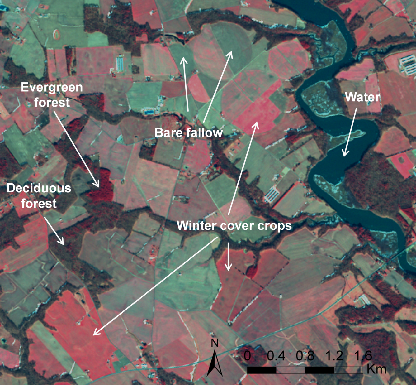
Wintertime satellite imagery of Maryland farmland shows areas with higher amounts of green vegetation in deeper red colors. Bare fallow fields are distinguishable from cover crops and winter cereal crops, and evergreen forest is distinguishable from deciduous forest. Calibration with field sampling data can be used to convert vegetation index values to estimates of aboveground biomass and vegetative ground cover. Confidential access to the privacy-protected enrollment data from the cover crop incentive program links the satellite-derived performance measures to agronomic management practices, informing the adaptive management of conservation incentive programs.
Sources/Usage
Public Domain.
Add from at the core site, most info should be there