
Kīlauea summit eruption in Halemaʻumaʻu crater – first week GIF

Detailed Description
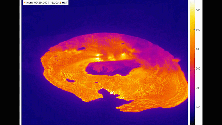
This animated image file (GIF) shows one week of images from the Kīlauea summit F1cam thermal webcam taken between 10:00 a.m. on September 29 and 10:00 a.m. on October 6, using one image every hour. The Kīlauea summit eruption, which began within Halema'uma'u at 3:21 p.m. on September 29, has created a lava lake that has covered most of the lava erupted between December 2020–May 2021. The solidified "lava island" from the last eruption is visible in the center (dark blue) and the top of the old west vent cone is visible to the west (below island). The lava fountains in the central and southern (right) portions of the lake have diminished since the eruption started and the west vent (growing into view in the lower right) remains the most vigorous. The northern surface of the lava lake appears to be in the process of stagnating and forming a thicker crust due to the distance from active vents. This slow crustal growth is similar to what was seen in the last summit eruption. The temperature scale on the right is in degrees Celsius. USGS animation by L. DeSmither.
Sources/Usage
Public Domain.