
Land Cover Modeling Example
By Earth Resources Observation and Science (EROS) Center
2020 (approx.)
Detailed Description
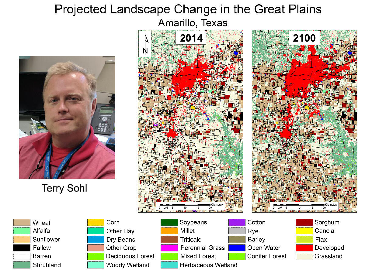
The USGS land cover modeling team used the homegrown Forecasting Scenarios of land use (FORE-SCE) model to project scenarios of landscape change in the Great Plains. Here a future scenario near Amarillo, Texas depicts urban growth and increases in cropland (primarily wheat), as well as conversion of grassland to shrubland as the projected climate gets hotter and drier.
Sources/Usage
Public Domain.