
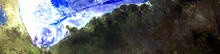
Landsat 8 image of Etoshapan, acquired April 18, 2013

Detailed Description
This image of a portion of the Etosha Salt Pan, a large endorheic salt pan forming part of the Kalahari Basin in the north of Namibia in Africa, was created using data acquired from the Landsat 8 satellite on April 18, 2013. Bands 761were used to highlight the mineral deposits and water within and along the shores of the salt pan area. Landsat data can be downloaded from the USGS EarthExplorer.
Sources/Usage
Public Domain.