
Landsat image of northern Alaska
Detailed Description
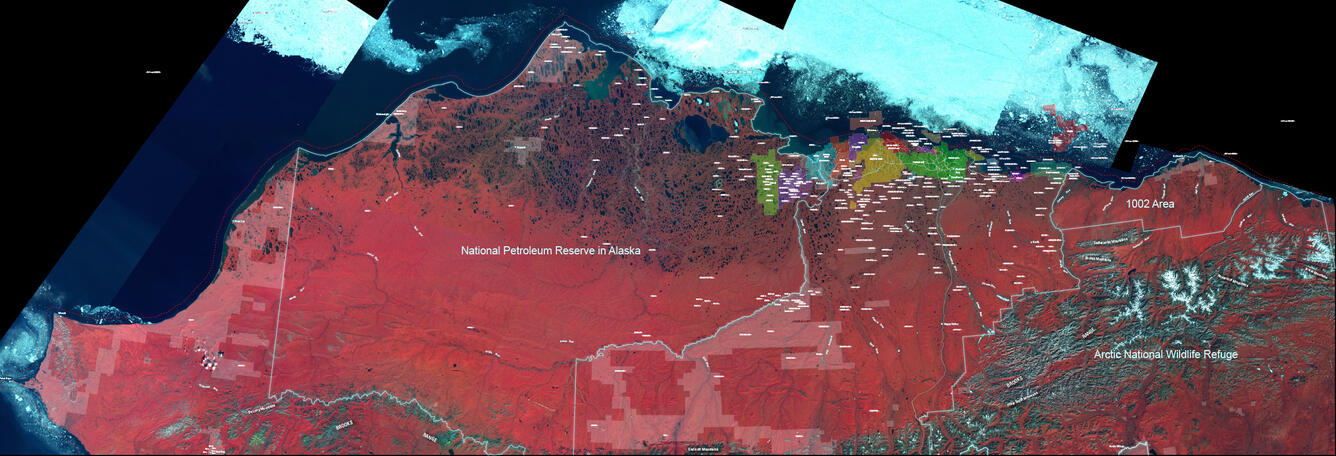
False-color composite Landsat image of northern Alaska showing boundaries of the National Petroleum Reserve in Alaska (NPRA) and the Arctic National Wildlife Refuge (including “1002 Area”), Native lands (transparent white polygons, existing and proposed oil fields (colored polygons), and exploration wells (white labels). Project work extends across the full 650-mile width of the North Slope and adjacent offshore.
Sources/Usage
Public Domain.
Related

Alaska Petroleum Systems
The Alaska Petroleum Systems project has three main objectives: (A) conduct research that increases our understanding of Alaska petroleum systems, (B) conduct assessments of undiscovered oil and gas resources, and (C) deliver energy-resource information to land and resource managers, policy makers, and the public.
Related
Alaska Petroleum Systems
The Alaska Petroleum Systems project has three main objectives: (A) conduct research that increases our understanding of Alaska petroleum systems, (B) conduct assessments of undiscovered oil and gas resources, and (C) deliver energy-resource information to land and resource managers, policy makers, and the public.