
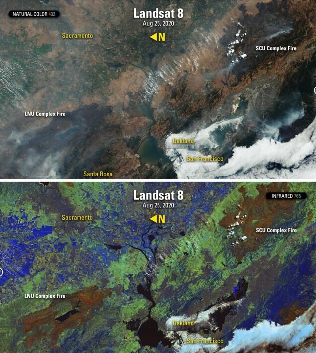
Landsat images of the LNU Complex fires, August 25, 2020
Detailed Description
The National Space Policy serves as the foundation and guides the Nation’s space interests. The Landsat Earth observing satellites operated by USGS and NASA, provide critical information and data to emergency responders, land and resource managers, and scientists who use the imagery to safeguard and protect lives, property and the nation’s natural resources. These fires (top picture) were captured during the day by Landsats 7 and 8, in natural color bands of the visible spectrum. Landsat sensors also record infrared wavelengths (bottom picture) revealing burn scars and active fires. Natural color images show smoke, wind direction, and fire proximity to nearby communities. Infrared scenes emphasize each fire's growing footprint. Photo Credit: USGS Landsat 7&8 imagery acquired on August 25, 2020
Sources/Usage
Public Domain.