
Landsat landcover classification along the Maryland and Virginia coast
Detailed Description
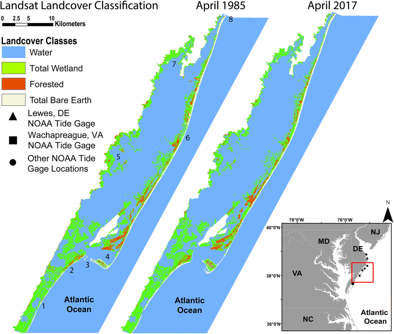
A. April 1985 and B. April 2017 Landsat-derived water, total wetland, forested, and total bare earth land-cover classifications. Numbered features are (1) Assawoman Island, (2) Wallops Island, (3) Chincoteague Inlet, (4) Tom’s Cove, (5) Johnson Bay, (6) Assateague Island, (7) Newport Bay, and (8) Ocean City Inlet. Inset map displays the locations of tidal gages used in this study. Creative Commons Attribution 4.0 International Public License, no changes were made. Source: https://doi.org/10.1007/s11273-018-9635-6.
Sources/Usage
Creative Commons Attribution 4.0 International Public License
Analysis of multi-decadal wetland changes, and cumulative impact of multiple storms 1984 to 2017
Douglas, S.H., Bernier, J.C. & Smith, K.E.L. Wetlands Ecol Manage (2018) 26: 1121. https://doi.org/10.1007/s11273-018-9635-6