
Lidar Base Specification version 1. 3 Figure 17
By NGP Standards and Specifications
February 2018 (approx.)
Detailed Description
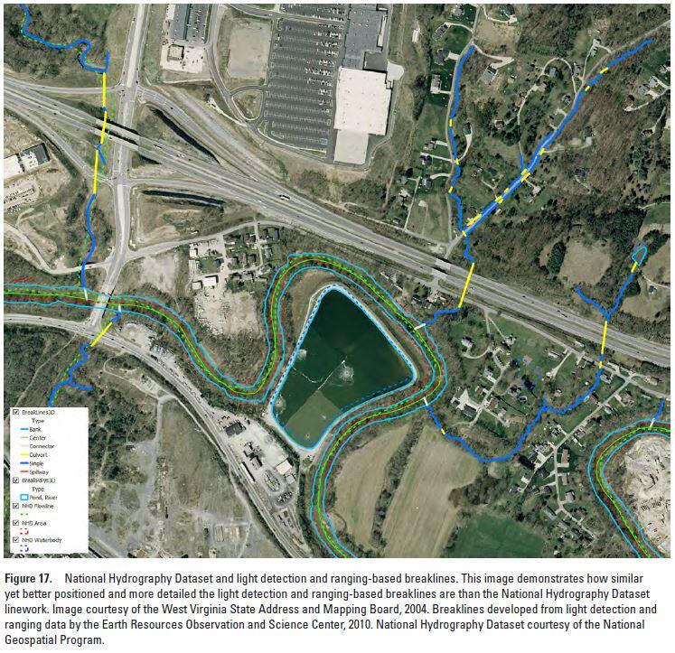
Lidar Base Specification v. 1.3: Figure 17. National Hydrography Dataset and light detection and ranging-based breaklines. This image demonstrates how similar yet better positioned and more detailed the light detection and ranging-based breaklines are than the National Hydrography Dataset linework. Image courtesy of the West Virginia State Address and Mapping Board, 2004. Breaklines developed from light detection and ranging data by the Earth Resources Observation and Science Center, 2010. National Hydrography Dataset courtesy of the National Geospatial Program.
Sources/Usage
Public Domain.