
Lidar Base Specification version 1. 3 Figure 18
By NGP Standards and Specifications
February 2018 (approx.)
Detailed Description
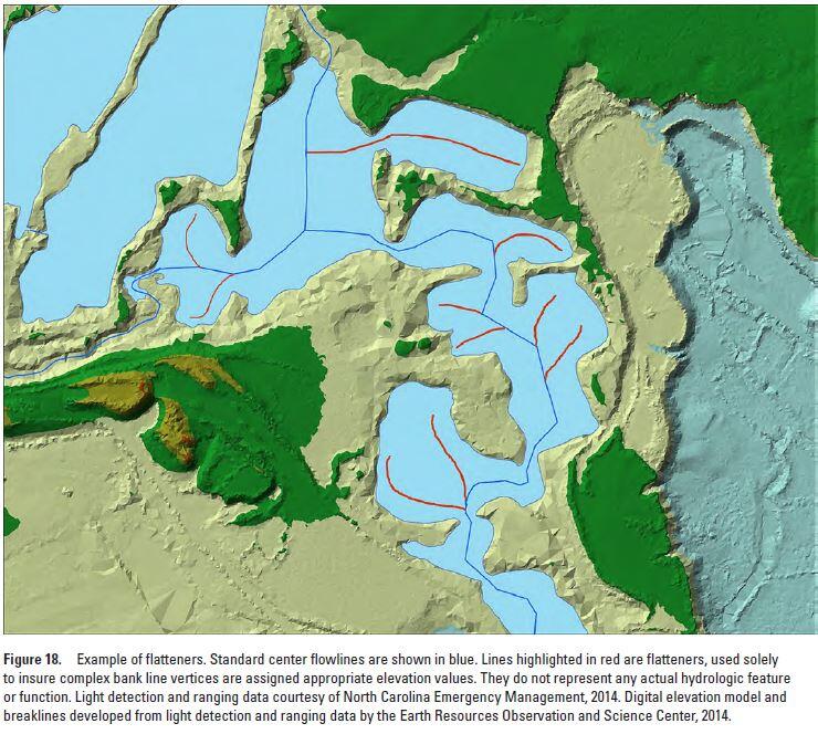
Lidar Base Specification v. 1.3: Figure 18. Example of flatteners. Standard center flowlines are shown in blue. Lines highlighted in red are flatteners, used solely to insure complex bank line vertices are assigned appropriate elevation values. They do not represent any actual hydrologic feature or function. Light detection and ranging data courtesy of North Carolina Emergency Management, 2014. Digital elevation model and breaklines developed from light detection and ranging data by the Earth Resources Observation and Science Center, 2014.
Sources/Usage
Public Domain.