
Lidar Base Specification version 1. 3 Figure 7
By NGP Standards and Specifications
February 2018 (approx.)
Detailed Description
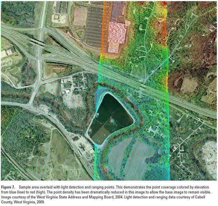
Lidar Base Specification v. 1.3: Figure 7. Sample area overlaid with light detection and ranging points. This demonstrates the point coverage colored by elevation from blue (low) to red (high). The point density has been dramatically reduced in this image to allow the base image to remain visible. Image courtesy of the West Virginia State Address and Mapping Board, 2004. Light detection and ranging data courtesy of Cabell County, West Virginia, 2009.
Sources/Usage
Public Domain.