
Lidar Base Specification version 1. 3 Figure 8
By NGP Standards and Specifications
February 2018 (approx.)
Detailed Description
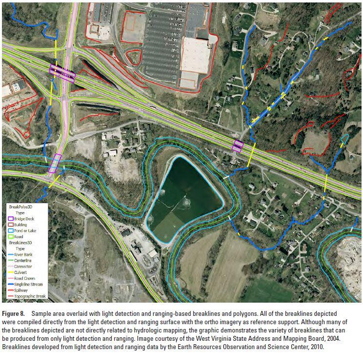
Lidar Base Specification version 1.3: Figure 8. Sample area overlaid with light detection and ranging-based breaklines and polygons. All of the breaklines depicted were compiled directly from the light detection and ranging surface with the ortho imagery as reference support. Although many of the breaklines depicted are not directly related to hydrologic mapping, the graphic demonstrates the variety of breaklines that can be produced from only light detection and ranging. Image courtesy of the West Virginia State Address and Mapping Board, 2004. Breaklines developed from light detection and ranging data by the Earth Resources Observation and Science Center, 2010.
Sources/Usage
Public Domain.