
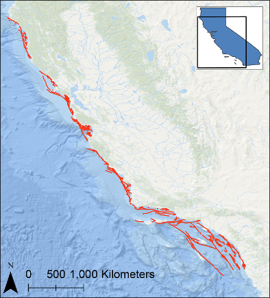
Location map of quaternary faults offshore of California

Detailed Description
A comprehensive map of Quaternary faults has been generated for offshore of California. The Quaternary fault map includes mapped geometries and attribute information for offshore fault systems located in California State and Federal waters. The polyline shapefile and matching KML file have been compiled from previously published mapping where relatively dense, high-resolution marine geophysical data exist. The data are accompanied by a PDF containing citations for the compiled source data. Most of the marine geophysical data used for mapping have been processed, merged, and released by the USGS in maps, data releases, and journal publications in support of the California Seafloor Mapping Program and the U.S. West Coast and Alaska Marine Geohazards Project.
Sources/Usage
Public Domain.
USGS Data Release
Quaternary faults offshore of California