
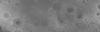
LRO LOLA and Kaguya Terrain Camera DEM Merge 60N60S 512ppd

Detailed Description
The LOLA and Kaguya Teams have created an improved lunar digital elevation model (DEM) covering latitudes within ±60°, at a horizontal resolution of 512 pixels per degree (∼59 m at the equator) and a typical vertical accuracy ∼3 to 4 m. This DEM is constructed from ∼4.5×10⁹ geodetically-accurate topographic heights from the Lunar Orbiter Laser Altimeter (LOLA) onboard the Lunar Reconnaissance Orbiter, to which we co-registered 43,200 stereo-derived DEMs (each 1°×1°) from the SELENE Terrain Camera (TC) (∼1010 pixels total). After co-registration, approximately 90% of the TC DEMs show root-mean-square vertical residuals with the LOLA data of <5 m compared to ∼50% prior to co-registration. We use the co-registered TC data to estimate and correct orbital and pointing geolocation errors from the LOLA altimetric profiles (typically amounting to <10 m horizontally and <1 m vertically). By combining both co-registered datasets, we obtain a near-global DEM with high geodetic accuracy, and without the need for surface interpolation. We evaluate the resulting LOLA + TC merged DEM (designated as “SLDEM2015”) with particular attention to quantifying seams and crossover errors. Map values are referred to a radius of 1737400 m.
Sources/Usage
Public Domain.