
LS Preliminary Puerto Rico
Detailed Description
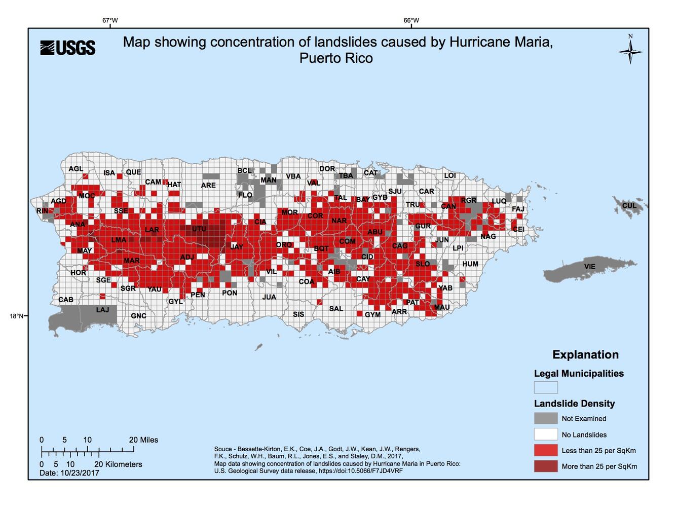
Gridded map of Puerto Rico showing the concentration of landslides. Dark red squares are grid areas with >25 landslides/km2, red squares are grid areas with <25 landslides/km2, white squares are grid areas with no landslides, and gray squares indicate the grid was not examined.
Sources/Usage
Public Domain.