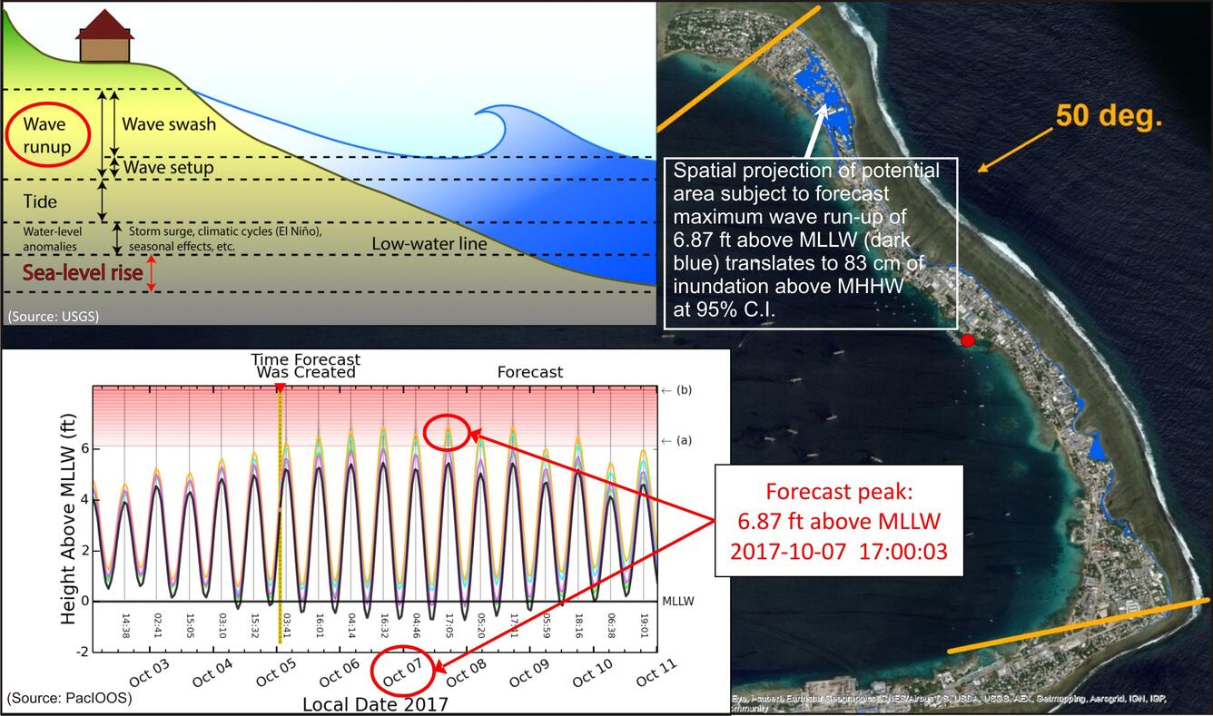
Majuro Atoll topobathymetry figure
By Earth Resources Observation and Science (EROS) Center
2018 (approx.)

Detailed Description
A figure from the AGU session "Enhancing the topobathymetric infrastructure using integrated remote sensing methods to mitigate coastal hazards."
Sources/Usage
Public Domain.

