
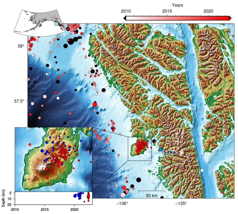
Map of earthquakes between 1990 and 2022 beneath Mount Edgecumbe near Sitka, Alaska.

Detailed Description
Map showing earthquake epicenters near Sitka Alaska from 1990 through 2022 using data from earthquake.usgs.gov. Epicenters before 2010 are shown as black circles, and from 2010 to the present they are color-coded by date (see legend for timeline). Inset shows epicenters at Kruzof Island for the same time period. Lower panel in inset shows earthquake focal depth versus time from 2010 to the present with blue symbols for from 2020 through 2021 and red symbols for 2021 to the present. Figure by Ronni Grapenthin, AVO/UAFGI
Sources/Usage
Public Domain.