
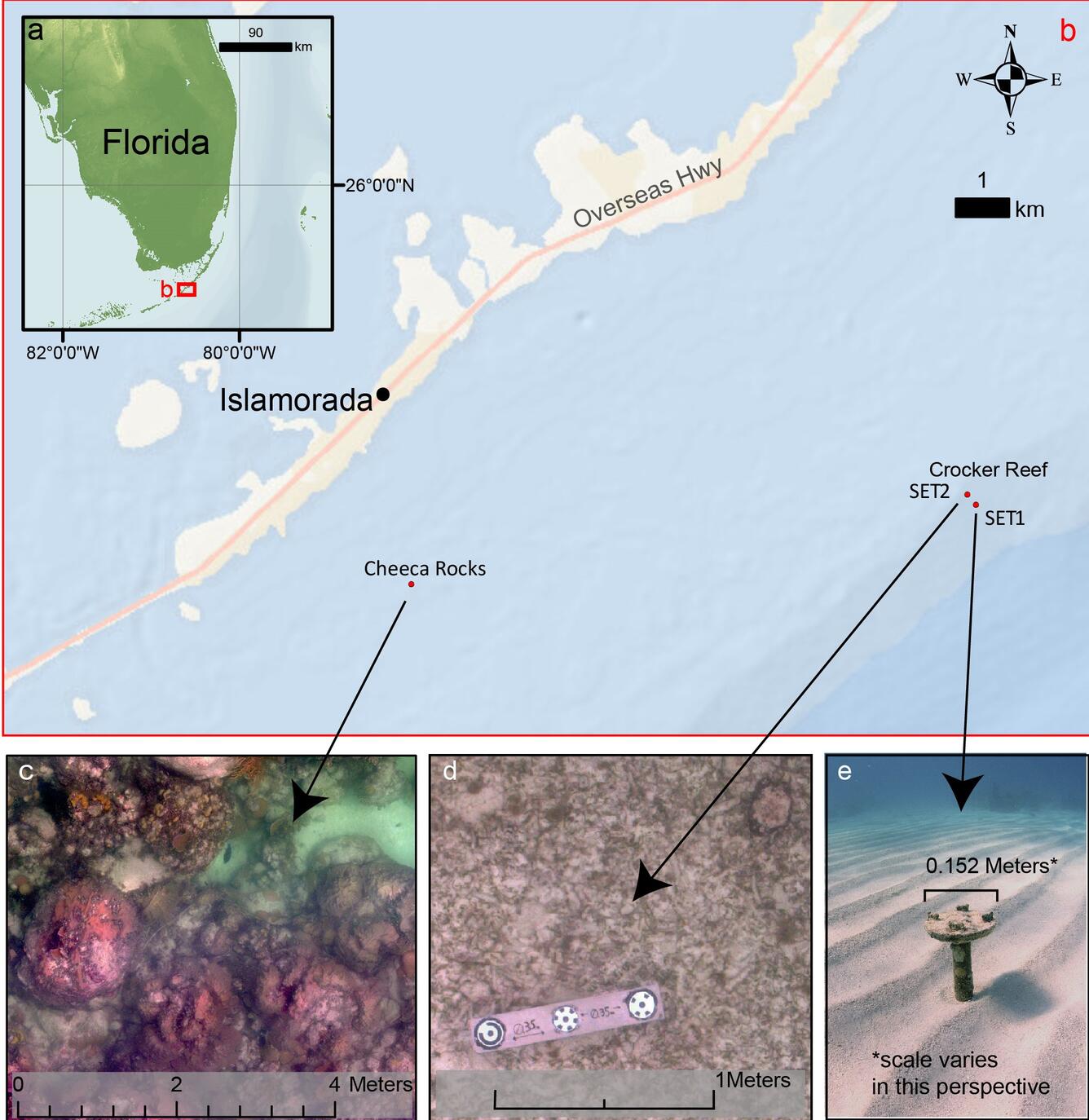
Map of Florida Keys study area
Detailed Description
Image map of study area showing (a) study region, (b) study sites, (c, d) example orthomosaic images, and (e) photo of SET 1.
Sources/Usage
Public Domain.
USGS Data Release
SQUID-5 structure-from-motion point clouds, bathymetric maps, orthomosaics, and underwater photos of coral reefs in Florida, 2019